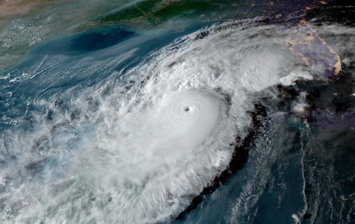
With Hurricane Season ’25 just over a week away from starting, experts with NOAA unveiled their seasonal forecasts for both the Atlantic and Central Pacific Hurricane Basins. In the Atlantic, NOAA is calling for an above level number of storms while in the Central Pacific, experts believe this will be a below normal season. In either case, the number of storms to make landfall on the U.S. coast is not defined nor is any intensity; forecasters also stress that it just takes one landfalling tropical cyclone to create a catastrophe for someone.
NOAA’s outlook for the 2025 Atlantic hurricane season, which goes from June 1 to November 30, says there’s a 60% chance of an above-normal season, a 30% chance of a near-normal season, and a 10% chance of a below-normal season. For the Central Pacific, which includes and surrounds the islands of Hawaii, NOAA says there’s a 50% chance of a near-normal season, a 30% of a below-normal season, and a 20% chance of an above normal season.
For the Atlantic, NOAA is forecasting a range of 13 to 19 total named storms . Of those, 6-10 are forecast to become hurricanes including 3-5 major hurricanes which are Category 3, 4 or 5 on the Saffir Simpson Wind Scale . NOAA has a 70% confidence in these ranges.

In the Central Pacific, NOAA ‘s forecast calls for 1-4 tropical cyclones across the central Pacific, which is located north of the equator between 140°W and the International Date Line. A near-normal season has 4 or 5 tropical cyclones.
Tropical cyclones include tropical depressions, tropical storms and hurricanes.
“NOAA and the National Weather Service are using the most advanced weather models and cutting-edge hurricane tracking systems to provide Americans with real-time storm forecasts and warnings,” said Commerce Secretary Howard Lutnick. “With these models and forecasting tools, we have never been more prepared for hurricane season.”
“As we witnessed last year with significant inland flooding from hurricanes Helene and Debby, the impacts of hurricanes can reach far beyond coastal communities,” said Acting NOAA Administrator Laura Grimm. “NOAA is critical for the delivery of early and accurate forecasts and warnings, and provides the scientific expertise needed to save lives and property.”
“Even though this season is predicted to be less active, now is the time for residents and businesses to prepare for hurricane season,” said Chris Brenchley, NOAA Central Pacific Hurricane Center director in Honolulu, Hawaii.
For the Atlantic, NOAA says a variety of factors are in play to produce a busy upcoming season. Continued ENSO-neutral conditions, warmer than average ocean temperatures, forecasts for weak wind shear, and the potential for higher activity from the West African Monsoon, a primary starting point for Atlantic hurricanes. All of these elements tend to favor tropical storm formation for the Atlantic basin. NOAA also says that this hurricane season also features the potential for a northward shift of the West African monsoon, producing tropical waves that seed some of the strongest and most long-lived Atlantic storms.
Neither El Niño nor La Niña is present in the Pacific, forecasters noted. The El Niño Southern Oscillation, which influences the intensity of hurricane season, is currently considered in its neutral phase. In a neutral phase, average sea surface temperatures are found near the equator. An El Niño in the Pacific Ocean usually indicates higher than average tropical cyclone activity due to warmer sea surface temperatures. In a La Niña season, the phenomena typically inhibits tropical cyclone activity. This is due to cooler-than-average sea surface temperatures and increased wind shear near the island chain.
For most years, the Central Pacific and Atlantic have an inverse number of tropical cyclones in their basin, with active Atlantic years paired with quiet Pacific years and vice versa. According to the NOAA outlooks, that will continue in the upcoming season.
“In my 30 years at the National Weather Service, we’ve never had more advanced models and warning systems in place to monitor the weather,” said NOAA’s National Weather Service Director Ken Graham. “This outlook is a call to action: be prepared. Take proactive steps now to make a plan and gather supplies to ensure you’re ready before a storm threatens.”
