According to the National Weather Service, odds are growing that a significant snowstorm will take shape from Kansas to New Jersey beginning this weekend and into the early part of the new week. In addition to heavy snow, there is also the potential for significant ice accumulations on the southern side of the storm system due to freezing rain and sleet.
“There is growing confidence in a winter storm that is likely to bring impactful wintry weather this weekend,” said the National Weather Service in a PM update today. “Impacts begin in the Northern Plains on Friday, followed by the Central Plains, Ohio/Tennessee Valleys, and Mid-Atlantic this weekend into early next week.”
There is also a heavy snow threat with this storm: heavy snow is possible in portions of the Central Plains and Mississippi Valley along and north of Interstate 70. The heavy snow potential then extends east through the Ohio Valley on Sunday and potentially into the Mid-Atlantic Sunday night and Monday.
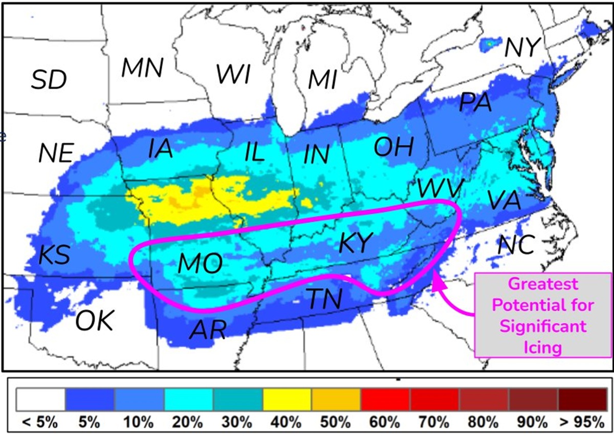
To the south of there, there is concern for an area of potentially significant sleet and freezing rain from southern Kansas and the Ozarks east to the Tennessee Valley over the weekend. Some icing may also unfold in parts of the southern Appalachians on Sunday as very cold air moves south.
It is too soon to say with a high degree of confidence of how much snow and ice will accumulate, but odds are growing that this region could see impactful accumulations of snow or ice in the days ahead. People in the forecast zone should be prepared for a significant major winter storm threat.
