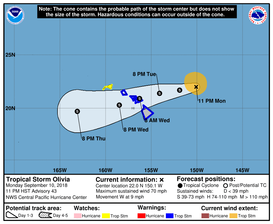
Tropical Storm Olivia is forecast to strike Hawaii on Wednesday morning, becoming one of the few rare named tropical cyclones to cross the state. Landfall is expected early Wednesday morning somewhere between Oahu and Hawaii islands. Due to the threat of tropical storm force winds, the Central Pacific Hurricane Center has issued Tropical Storm Warnings for Maui, Oahu, and Hawaii counties while a Tropical Storm Watch is in effect for Kauai.
Olivia is visiting Hawaii just weeks after a glancing blow by Hurricane Lane. However, the Central Pacific Hurricane Center cautions to people in Hawaii to resist the temptation to make comparisons between Lane and
Olivia. “Although Lane was a stronger tropical cyclone near the islands, it did not bring direct core impacts to the state. In some areas, Olivia could bring significantly worse impacts than those brought by Lane. Those impacts could include intense flooding rainfall, damaging winds, and large and dangerous surf,” writes Honolulu-based National Weather Service meteorologist Robert Ballard in the latest Forecast Discussion for the Storm.”

While the forecast cone for Olivia has been updated, the Central Pacific Hurricane Center (CPHC) also cautions of its use. “It is important to not focus on the exact forecast track and intensity when planning for Olivia,” the CPHC says. Regardless of the track that Olivia takes as it approaches the islands, significant impacts can be expected away from the center. In particular, the mountainous terrain of Hawaii can produce localized areas of strongly enhanced wind gusts and rainfall.”
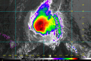
As of the latest advisory issued at 5am ET / 11pm HT, the center of Tropical Storm Olivia was located by aircraft near latitude 22.0 North, longitude 150.1 West. Olivia is moving toward the west near 9 mph (15 km/h). A turn to the west and west-southwest is expected early Tuesday, with this general motion continuing for the next couple of days. On the forecast track, the center of Olivia will be moving over the main Hawaiian Islands late Tuesday night into Wednesday. Maximum sustained winds are near 70 mph with higher gusts, making Olivia a hair below Category 1 hurricane strength. Gradual weakening is forecast during the next 48 hours, but Olivia is expected to remain a tropical storm as it moves over the islands. Tropical-storm-force winds extend outward up to 105 miles from the center. The estimated minimum central pressure is 996 mb or 29.42 inches.
Olivia will threaten Hawaii with wind, rain, and surf. Tropical storm conditions are expected over Maui County and the Big Island starting late Tuesday or Tuesday night. Tropical storm conditions are expected over Oahu starting late Tuesday night or Wednesday morning. Tropical storm conditions are possible over Kauai County starting Wednesday afternoon or evening. Olivia is expected to produce total rainfall accumulations of 10 to 15 inches, with isolated maximum amounts of 20 inches possible. This rainfall may produce life-threatening flash flooding and trigger rockfalls and landslides. Large swells generated by Olivia will impact the main Hawaiian Islands over the next couple of days. This will cause surf to build, mainly along exposed east facing shores, and surf may become damaging. Even experienced surfers and swimmers should stay out of the water.