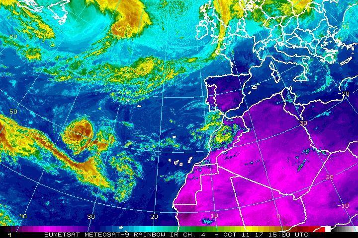
Ophelia, the 15th named tropical cyclone of the 2017 Atlantic Hurricane Season, continues to spin about in the open waters of the Atlantic Ocean; in time, it may threaten Europe.
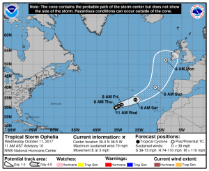
As of the morning advisory from the National Hurricane Center (NHC), the center of Tropical Storm Ophelia was located near latitude 30.0 North, longitude 36.5 West. Ophelia is moving toward the east near 3 mph, and this slow motion is expected to continue today with a gradual turn to the northeast Thursday night. Maximum sustained winds are near 70 mph with higher gusts. Some strengthening is forecast and Ophelia is anticipated to become a hurricane at any time today or tomorrow. Tropical-storm-force winds extend outward up to 70 miles from the center. The estimated minimum central pressure is 992 mb (29.30 inches).

In the latest forecast track from the NHC, Ophelia is forecast to travel east north east followed by a more northeast track. By Monday, the center of Ophelia’s circulation should be just west of southwestern Ireland. The storm will also get close to the Atlantic coast of Portugal and Spain; people there should continue to monitor this storm even though those countries are not in the NHC forecast cone at this time. While the system is forecast to weaken by the time it arrives near or in Europe, it will still bring the threat of damaging winds and flooding rains to the continent over time.