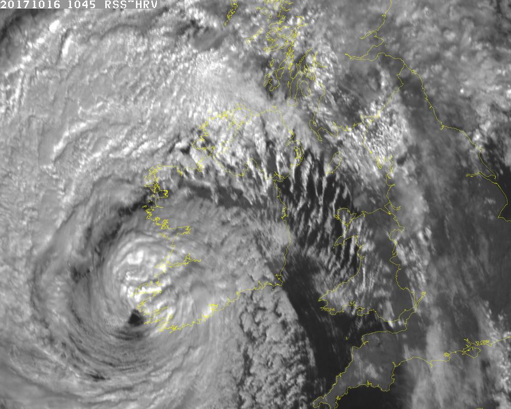
Ophelia is striking Ireland at this hour, bringing heavy rain and destructive winds across the nation. A satellite image released by Met Eireann, Ireland’s official meteorological agency, a short time ago shows the center of circulation of the former Category 2 hurricane wrapped by bands of heavy rain and wind. While the storm transformed from a tropical cyclone to an extra tropical cyclone yesterday, the impacts are the same to people on Ireland: destructive Category 1 – 2 hurricane force winds and heavy, flooding rains.
Met Eireann issued a “STATUS RED”, the highest warning possible for the arrival of Ophelia. In their latest update, they warn, “Violent and destructive wind gusts of 120 – 150 km/h (74- 93mph) are forecast countrywide and in excess of these values in some very exposed hilly and coastal areas. The most severe winds over Munster and south Leinster at present, and will extend quickly to the rest of the country this afternoon. Also heavy rain and storm surges along some coasts will result in flooding. There is danger to life and property.”
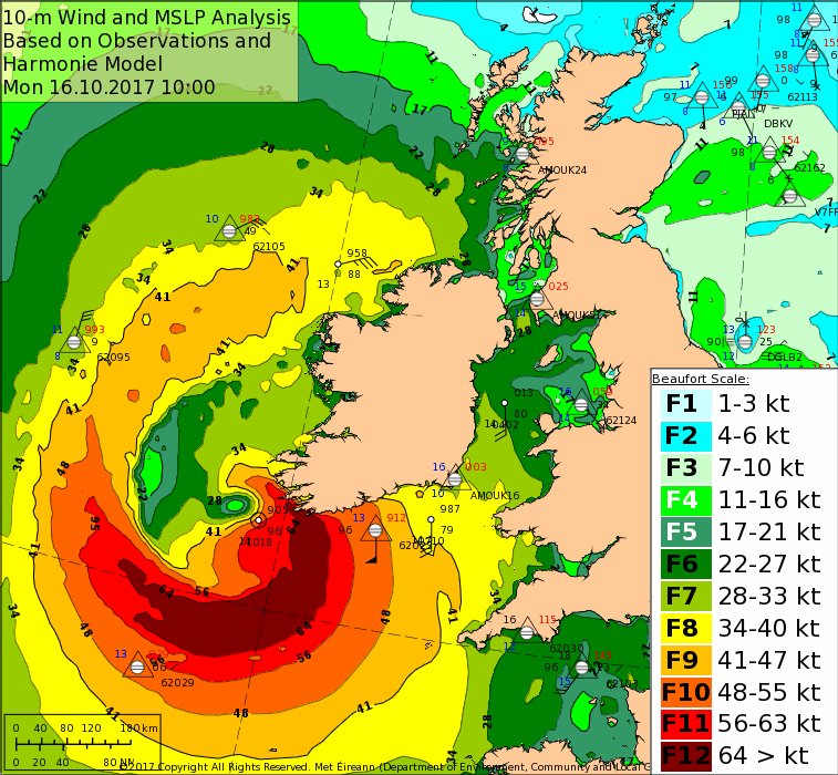
Damaging wind gusts have already been reported around Ireland. Cork Airport reported a gust of 124 km/h (77mph) while Fastnet Rock, a lighthouse off the southwest coast reported 176 km/h (109mph)winds.
Ophelia broke records over the weekend, becoming the most powerful hurricane ever recorded in the eastern Atlantic. Hurricanes in the northeastern Atlantic are very rare; the last tropical cyclone to strike Ireland was 1961’s Debbie.
The US National Hurricane Center has worked with Met Eirann and the United Kingdom’s Met Office to collaborate on forecasts, watches, and warnings.
