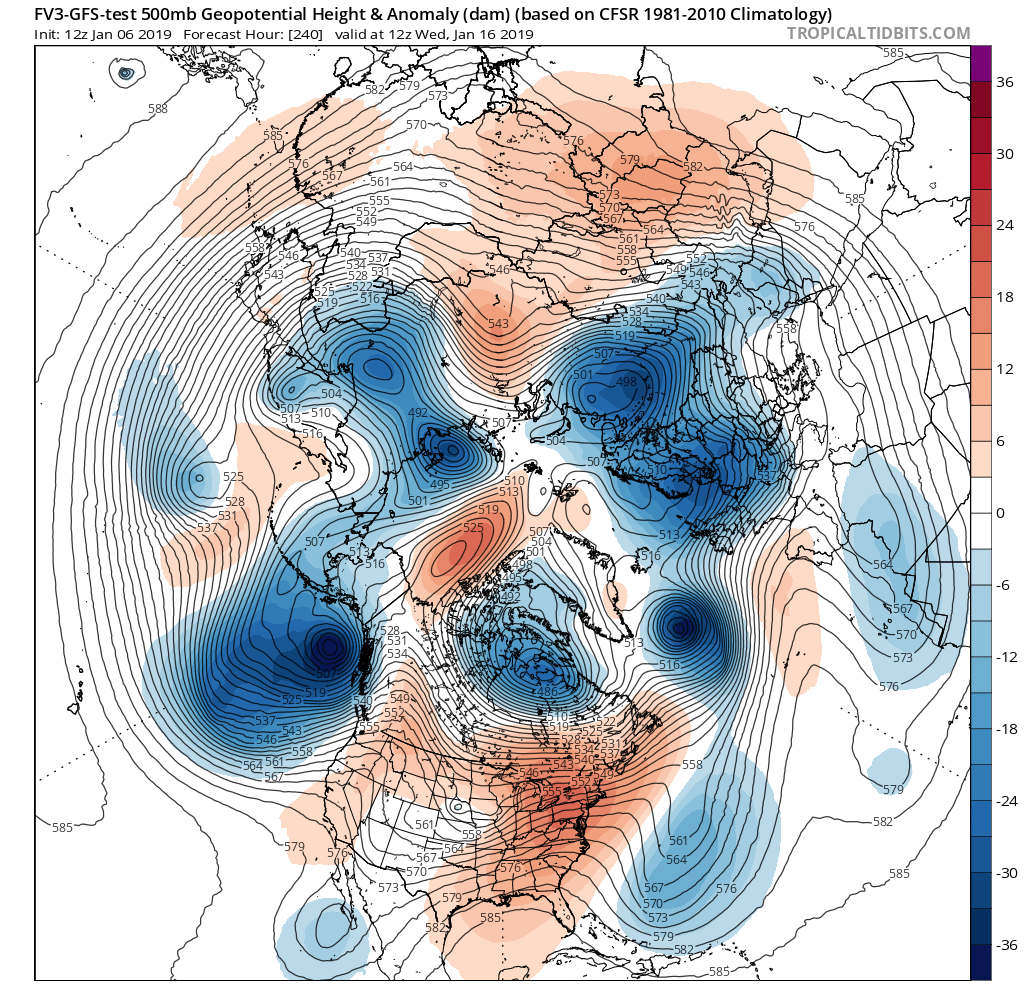
An anomalous ridge in the east and a strong flow from the Pacific are conspiring against snow lovers in the eastern U.S.: the pattern this month simply prohibits big snow storms and cold weather outbreaks.
With a steady stream of moisture and energy racing across the Pacific and across the country, the current weather pattern isn’t allowing for storms to ride up the East Coast nor is it allowing much in the way of frigid air locked-up over Canada to dip south into the U.S. As such, the January pattern this year is supporting frequent rain storms in the eastern US with higher elevation snow in far northern New England.
Both the American GFS and European ECMWF forecast models lack any signals that would show a significant snowstorm forming over the next 1-2 weeks. While the European ECMWF suggests a Mid Atlantic light snow event in about a week, both models depict a pattern similar to what has been experienced over the last 2 weeks: fast moving systems, occasional rain, and no real cold spells.
Extended forecast guidance, while not that accurate this season, is showing more of the same for the balance of the month. If that comes to fruition, it is possible that places like Boston, New York, and Philadelphia may not see any measurable snow in January this year.