• Skip to primary navigation
  • Skip to main content
  • Skip to primary sidebar

Weatherboy

Weatherboy Weather News, Maps, RADAR, Satellite, and Forecasts.

  • Local
  • Earth Science News
  • RADAR
  • Current Warnings
  • Satellite
  • Current Maps
  • Forecast Maps
  • Video

People Report Shaking as World’s Largest Volcano Rattles

by Weatherboy Team Meteorologist - August 23, 2022

Mauna Loa rises above the Kapapala Forest Reserve on the east side of the Big Island of Hawaii. Image: Weatherboy


More than 100 people have reported to USGS that they felt an earthquake near the world’s largest volcano: at 7:11 pm local time / 1:11 am ET, a magnitude 4.0 earthquake struck near Pahala, Hawaii, near the Mauna Loa volcano. Light shaking was reported in the first hour after the earthquake by 111 people using USGS’s “Did you feel it?” online reporting tool across Hawaii’s Big Island.

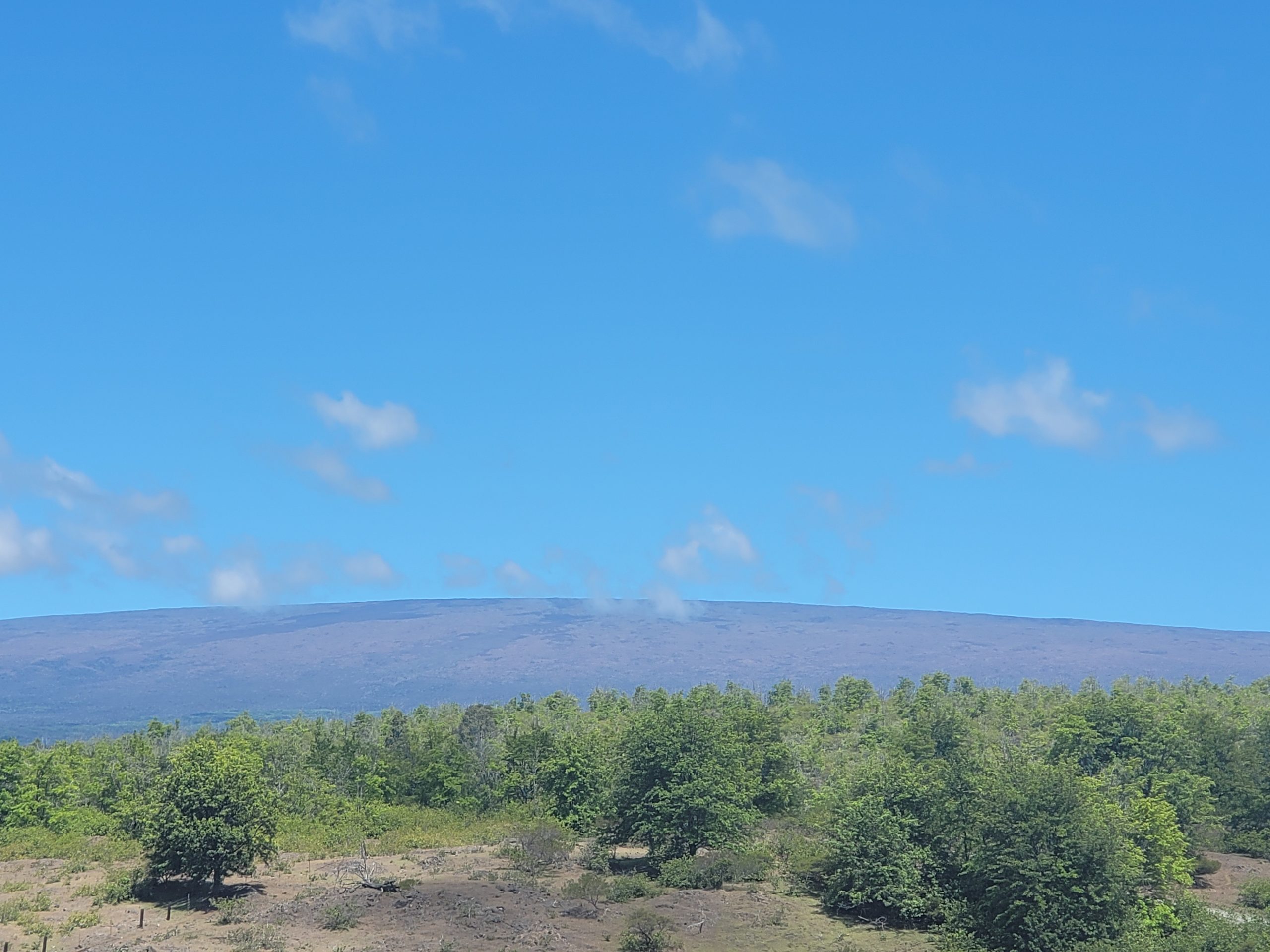
Mauna Loa is considered the largest active volcano on Earth, rising to 13,681 feet above sea level. Mauna Loa rises up from the ocean floor of the Central Pacific at a depth of about 3 miles. Because of the volcano’s significant mass, the ocean floor directly beneath Mauna Loa is depressed by another 5 miles. According to USGS, this places Mauna Loa’s summit about 56,000 feet above its base; the enormous volcano covers half of the island of Hawaii, also known simply as the “Big Island of Hawaii.”

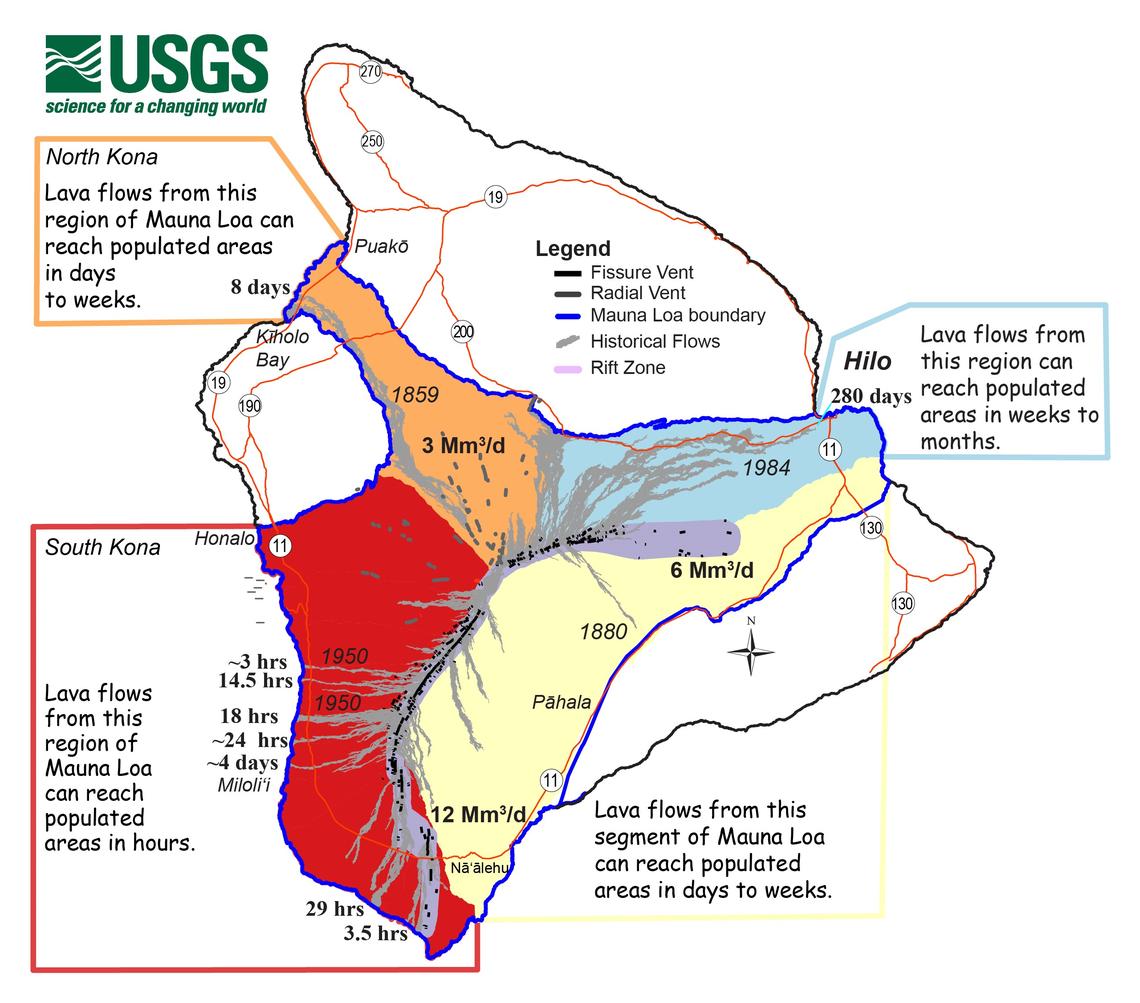
Mauna Loa eruptions tend to produce voluminous, fast-moving lava flows that can impact communities on the east and west sides of the Big Island from Kona to Hilo.  Since the 1850s, Hilo in eastern Hawaii has been threatened by 7 Mauna Loa lava flows. On the south and west sides of the island, Mauna Loa lava flows have reached the coast there 8 times: in 1859, 1868, 1887, 1926, 1919, and three times in 1950.

This map shows the response time people can expect based on Mauna Loa eruptions over the past 200 years. Different sectors around Mauna Loa are colored according to how quickly lava flows can reach populated areas. The warmer the color, the more quickly the flows travel. Mauna Loa lava flows over the past 200 years are shown in gray, and the numbers along the coastline indicate lava travel times to the ocean after the vent(s) opened. Large, bold numbers record the average effusion rates for the different parts of the volcano in millions of cubic meters per day (Mm3/d). Image: USGS


Many scientists believe that lava flows underneath Pahala are on its way to Mauna Loa Volcano and Kilauea Volcano, a volcano that has been erupting for months now. Fortunately, the depth and location of this earthquake is consistent with the elevated deep activity around Pahala since 2019 and not indicative of a significant eruption at either volcano. In fact, USGS says these types of earthquakes generally do not change ongoing activity on Mauna Loa or Kilauea. Nevertheless, scientists are closely monitoring both volcanoes for any changing behavior.

According to USGS, while Mauna Loa is not erupting right now , rates of deformation and seismicity remain elevated above long-term background levels.  GPS measurements continue to show slow, long-term summit inflation consistent with magma supply to the volcano’s shallow storage system.


Primary Sidebar

Sponsored Ad

Search

Latest News

  • Updated Crash Forecast Puts Eastern U.S. on Alert from Soviet Union Spacecraft
  • Soviet Union Spacecraft Crash Zones Updated; NJ/NY/PA/MI at Increased Risk
  • Over 2,000 People Report Shaking from Virginia Earthquake
  • Morning Earthquake Strikes Heart of New Madrid Seismic Zone in Missouri Today
  • New York TV Weatherman Back After Brain Injury
  • NASA Monitoring Significant Magnetic Anomaly over Atlantic
  • Out of Control Soviet Union Spacecraft Could Crash Into Your House This Week
  • Elevated Tornado Threat in New Jersey, Pennsylvania, and New York
About | Careers | Contact | Contests
Terms | Privacy | Ad Choices
Weatherboy is a (R) Registered Trademark of isarithm LLC, All Rights Reserved.
All content herein is Copyright by Isarithm LLC 1997-2022