Confidence among meteorologists and the forecast models they use to help develop forecasts is high for significant impacts from a potent nor’easter along the U.S. East Coast this weekend. Flooding from heavy rain and coastal storm surge is becoming likely, as are wind-related issues, especially at coastal locations from Delaware to Massachusetts.
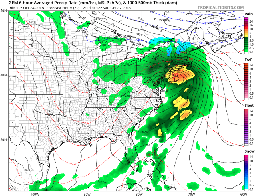
This weather pattern creating this robust coastal storm is rather complex. Leftover energy and moisture tied to what was once Major Hurricane Willa will gradually make its way to the eastern United States. A surface high pressure is forecast to be located near Lake Erie on Thursday morning; its center will move to the lower Hudson River Valley on Friday morning before moving off the coast on Friday afternoon. With the high moving away, the door will be open to allow a low to move up the coast for Saturday. Low pressure is forecast to grow as it moves up the coasts of Georgia and the Carolinas late Friday. Well ahead of the low, rain is anticipated to build up and into northeastern Maryland, Delaware, southern New Jersey and southeastern Pennsylvania during the afternoon on Friday. The surface low is forecast to reach the Virginia coast on Saturday morning and it is expected to be over New York City by Saturday evening. While a dry slot scenario is expected that’ll cut off precipitation as the center of the system moves nearby, very heavy rain and strong, potentially damaging winds are still likely to impact the northeast as the precipitation shield on the northern side of the system plows through.
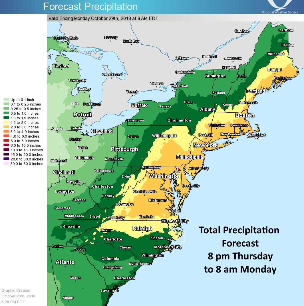 The heaviest precipitation will occur late Friday night into Saturday, with upwards of 2-3″ falling. Because some rain will fall over a short period of time, flooding and flash flooding will occur, with the greatest threat of fresh water flooding expected over portions of Delaware, eastern Maryland, eastern Pennsylvania, New Jersey, New York City, Long Island, southern Connecticut, Rhode Island, and southeastern Massachusetts.
In addition to heavy rain, strong winds will hit the area hard. Northeast to east winds will likely increase to perhaps 20 to 30 mph on the coastal plain and 15 to 20 mph inland. Higher gusts of 30-60 mph are possible at the coast while gusts of 20-40 mph are possible inland, with wind intensities increasing as you head towards the shoreline. With soaked soil and gusty winds, there’s a good chance trees and/or utility wires will tumble or break, leading to power outages. The greatest threat of wind-related issues will be in Delaware, New Jersey, Long Island, southern Rhode Island, and southeastern Massachusetts.
With strong on-shore winds, there will be coastal flooding with a storm surge of up to a few feet possible. The greatest threat of coastal flooding will be at Delaware Beaches and the New Jersey Shore, with the highest coastal flooding possible from Atlantic City, NJ to Lewes, DE. According to coastal flooding guidance from the Stevens Flood Advisory System, flooding will be moderate to major in southern New Jersey and Delaware; further up the Jersey coast, flooding will be moderate in places like Sea Bright, NJ. Further up the northeast coast, some flooding is also possible near New York City and Boston.

The dominant precipitation type with this storm will be liquid rain. While temperatures could be just cold enough for some snow at elevations over 1,000 feet in Pennsylvania, northern New Jersey, and interior central New England, at the start of the storm, any precipitation should quickly change over to plain rain and not create any significant wintry weather problems, especially near the more populated I-95 corridor.
The low is expected to lift to the north and northeast on Saturday night and Sunday, taking the potential for heavy rain and the strongest of the winds with it. However, clouds and light rain should linger in the Mid Atlantic on Sunday as a secondary, albeit weaker, system moves through. As a long wave mid level trough deepens over the eastern states early in the new week, another surface low is forecast to arrive from the west. While this system won’t be a potent coastal storm, it will bring a return of wet weather back to the Mid Atlantic and Northeast later Monday once again.
