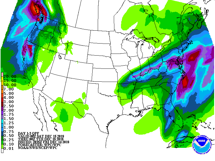
Another soaking low pressure system will bring heavy rain to portions of the Ohio Valley into the Mid-Atlantic this weekend while a new system off the Pacific Ocean will bring heavy precipitation to portions of northern California and the Pacific Northwest.
A storm over the Lower Mississippi Valley will move northeastward to the Mid-Atlantic by Sunday. The system will produce showers and thunderstorms along and near the associated front from parts of the Tennessee Valley into parts of the Southeast that will move off the Southeast Coast by Saturday afternoon. Rain will develop over parts of the Lower/Middle Mississippi Valley eastward into Mid-Atlantic/Southeast that will end over the Lower/Middle Mississippi Valley by Saturday evening. The rain will slowly end over the Southeast by overnight Saturday, while the rain will continue over parts of the Eastern Ohio Valley/Northern Mid-Atlantic through Sunday. In addition, upper-level energy over Southeastern Canada will move eastward over Northern New England and out over the Western Atlantic by Saturday night. The energy will aid in producing rain and snow over parts of the Lower Great Lakes into Northern New England ending by Sunday morning.
The weekend storm system will be more wet than white in the eastern U.S., with milder temperatures producing mainly rain. However, as colder air wraps into the system on Sunday, some of that rain could turn to wet snow over portions of the northern half of New Jersey, upstate New York, northeastern Pennsylvania, northern Connecticut, and Massachusetts before ending. While snow will mainly be on the light side here, some higher elevations could pick up 4-8″ of snow before the system exits on Sunday.
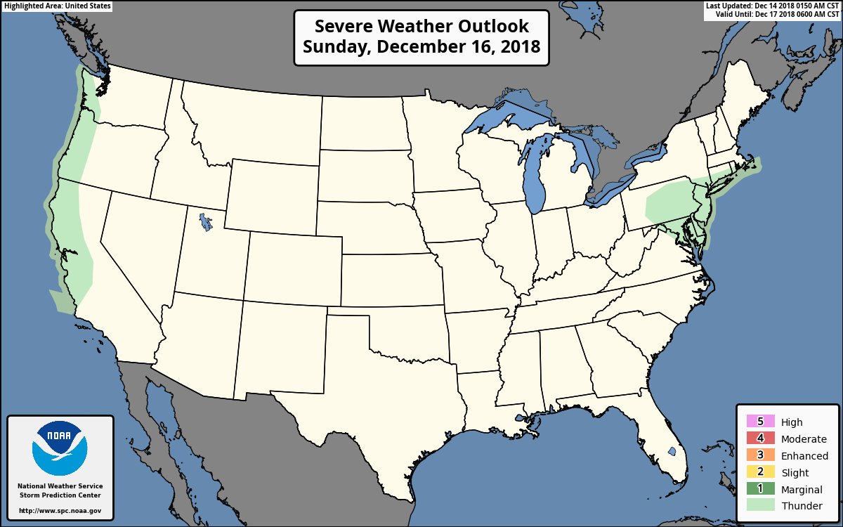
The National Weather Service also believes some convective activity is possible on Sunday as an upper level low moves through. While no severe storms are expected, scattered thunderstorms are possible; snow and/or rain could fall from these storms. As with any thunderstorm any time of the year, lightning can be deadly. The National Weather Service urges people to remember, even in winter, that “when thunder roars, head indoors.”
