In 2016, a major blizzard struck portions of the Mid Atlantic and Northeast, dropping up to 3 feet of snow in areas. Beyond being a high-impact storm, it was also a well forecast one with many meteorologists warning of its arrival days in advance.
Originating as a shortwave trough in the upper atmosphere, the storm arrived on the Pacific Northwest coast on January 15. As the system moved southeastward through the Great Plains, the shortwave trough gained strength. By January 21, the upper trough spawned a surface low over central Texas. This Texas storm then rapidly intensified as it moved through the Gulf Coast states, triggering a severe weather outbreak there. Numerous strong thunderstorms and tornadoes impacted the region then.
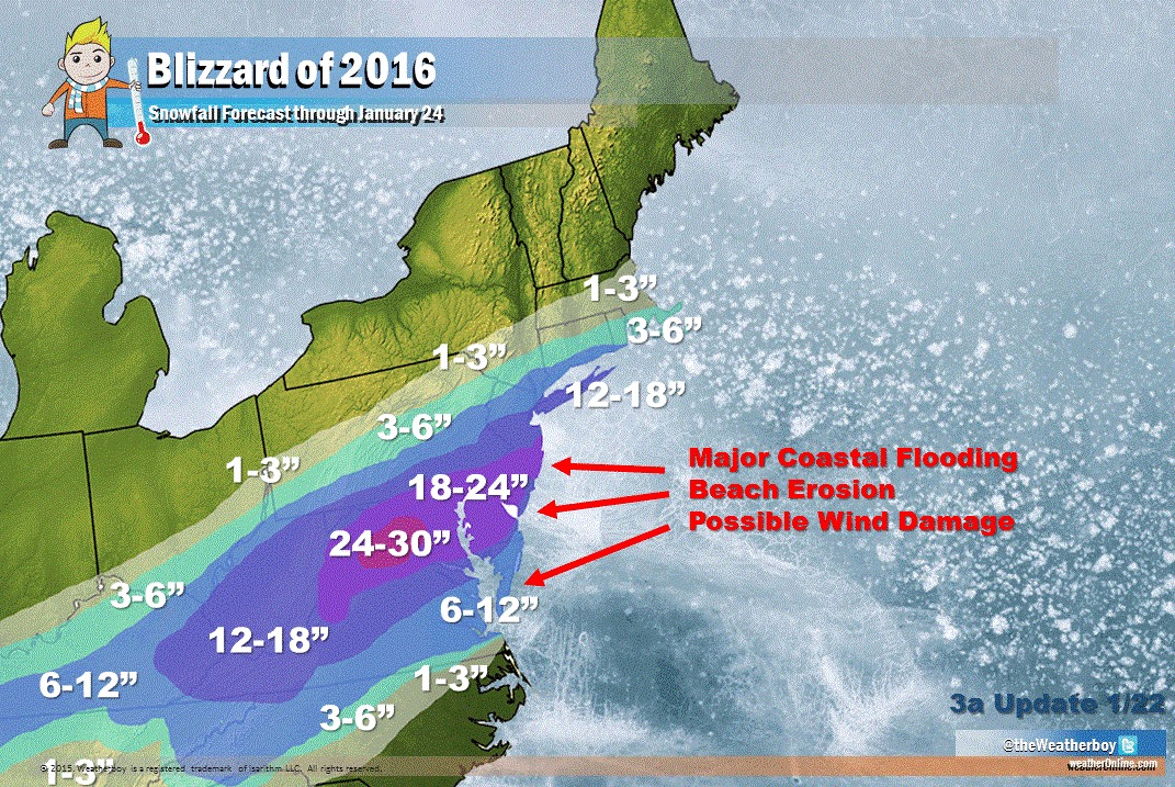
As the storm system tracked up the east coast, during the afternoon hours of January 22, a new low-pressure area began to develop over the coast of the Carolinas as the former storm tracked into central Georgia. The storm north and rapidly strengthened and on January 24, as the storm was leaving New England, the system began to become elongated, as a secondary low developed to the southwest of the storm’s central low.
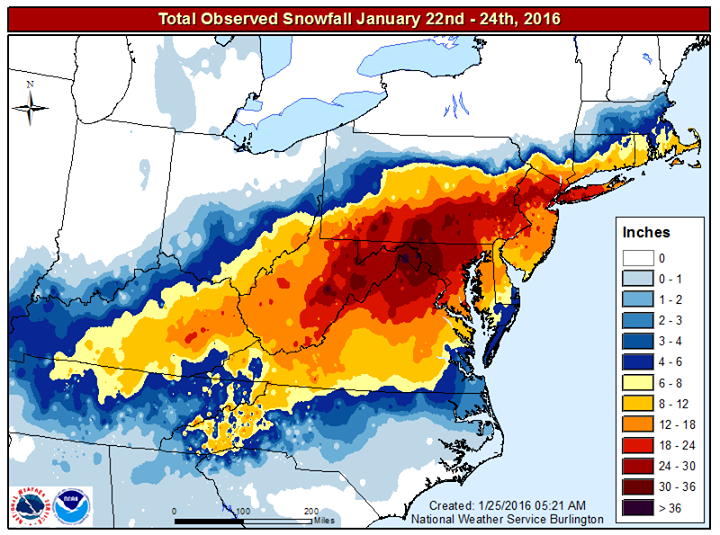
With strong high pressure over New England and that elongated low, the heavy snow never advanced further north then southern New England. The heaviest snow fell over West Virginia, Pennsylvania, Maryland, northern Virginia, New Jersey, and the New York City metro area. The heaviest amount of snow reported was 42″ in Glengary, West Virginia.
In response to the storm, New York’s Governor Cuomo issued a travel ban for all roads in New York City and Long Island. The New York City Transit Authority suspended bus service while the Port Authority closed the bridges and tunnels between New York and New Jersey.
The storm was ultimately responsible for 55 deaths and an estimated $3 billion in damages and lost wages.
