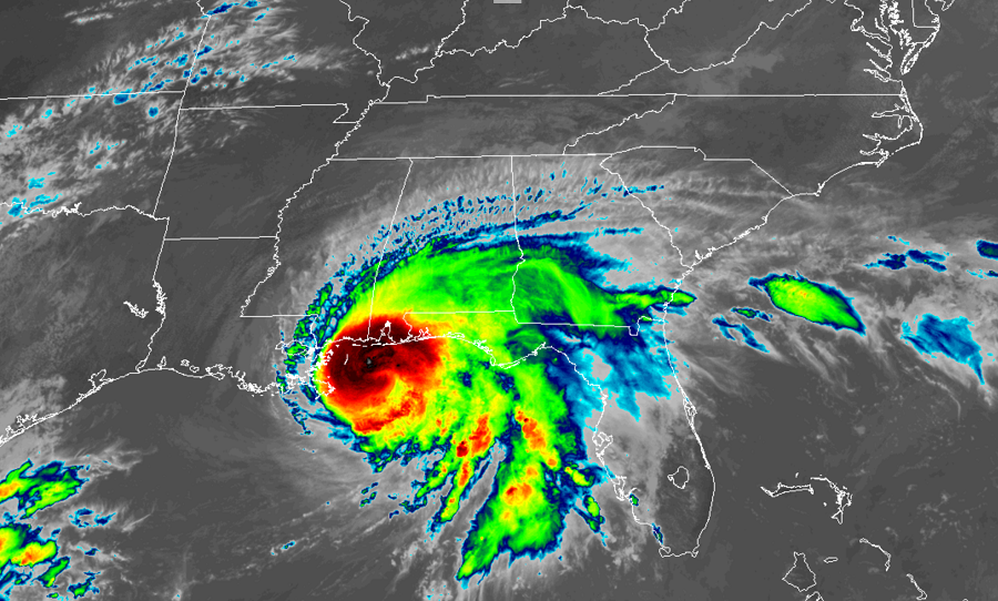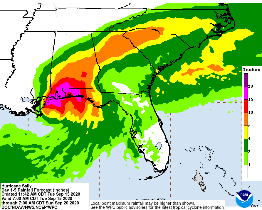
Hurricane Sally is nearly stalled at the Gulf Coast, creeping along to the northwest only at 2 miles per hour according to the latest forecast advisory from the National Hurricane Center (NHC). Due to the slow nature of this storm, an epic amount of rain will fall from it, compounding issues from storm surge, wind damage, and an ongoing tornado threat. A large area will see 1-2 feet of rain, with some areas possibly approaching 30″ by the time the storm eventually exits. Such epic rainfall amounts will lead to a tremendous amount of fresh water flooding over a broad area.
Hurricane Sally is forecast to produce 10 to 20 inches of rainfall with isolated amounts of 30 inches along and just inland of the central Gulf Coast from the western Florida Panhandle to far southeastern Mississippi. Historic flooding is likely with extreme life-threatening flash flooding likely through Wednesday. In addition, this rainfall will lead to widespread moderate to major flooding on area rivers. The flood threat isn’t just contained to the Gulf coast region too: heavy rain will soak a large part of the southeastern United States in the coming days. Northern Georgia and South Carolina could also see 6-10″ of rain with time.

Beyond the flood threat, a variety of hazards will impact the region as Sally drifts about. Due to those hazards, many watches and warnings are in effect.
A Storm Surge Warning is in effect from the Mouth of the Mississippi River to the Okaloosa/Walton County Line in Florida and for Mobile Bay. A Storm Surge Warning means there is a danger of life-threatening inundation, from rising water moving inland from the coastline, during the next 36 hours in the indicated locations. The National Hurricane Center says, “This is a life-threatening situation. Persons located within these areas should take all necessary actions to protect life and property from rising water and the potential for other dangerous conditions. Promptly follow evacuation and other instructions from local officials.”
If the peak surge occurs at the time of high-tide, it could be up to 4-7′ near the Mississippi / Alabama border to the Alabama / Florida border including Mobile Bay. It could also be 4-6′ from the Mouth of the Mississippi River to the Mouth of the Pearl River including Lake Borgne. Even far away from the landfall point, a 1-3′ storm surge could occur on the Gulf Coast.

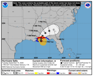
A Hurricane Warning is in effect for portions of the coast. Right now, the Hurricane Warning is up for the area east of Bay St. Louis to Navarre, Florida. Beyond there, a Tropical Storm Warning is in effect for east of Navarre, Florida to Indian Pass, Florida and for Bay St. Louis west to Grand Isle, Louisiana. A Hurricane Warning means that hurricane conditions are expected somewhere within the warning area. Preparations to protect life and property should be rushed to completion. A Tropical Storm Warning means that tropical storm conditions are expected somewhere within the warning area within 36 hours.
According to the National Hurricane Center, a slow north-northwestward to northward motion is expected this afternoon, followed by a slow northward to north-northeastward motion tonight through Wednesday night. On the forecast track, the center of Sally will pass near the coast of southeastern Louisiana today, and make landfall in the hurricane warning area late tonight or Wednesday.
Maximum sustained winds are near 80 mph with higher gusts. Although little change in strength is forecast until landfall occurs, Sally is still expected to be a dangerous hurricane when it moves onshore along the north-central Gulf coast. Hurricane-force winds extend outward up to 45 miles from the center and tropical-storm-force winds extend outward up to 125 miles . The latest minimum central pressure reported by a NOAA Hurricane Hunter aircraft is 982 mb or 29.00 inches.
Beyond storm surge and fresh water flooding and wind damage from the hurricane’s gusts, isolated tornadoes are also possible near and to the left of the center of Hurricane Sally as it creeps ashore.