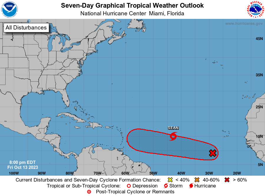
Tropical Storm Sean is slowly moving across the central Atlantic Ocean while the National Hurricane Center (NHC) is watching another area in which a new system is expected to form in the eastern Atlantic.
Based on the latest advisory issued by the NHC, Tropical Storm Sean is located about 1,260 miles west of the Cabo Verde Islands and about 1,355 miles east of the Northern Leeward Islands. With maximum sustained winds of 40 mph, it is moving to the west-northwest at 8 mph. The minimum central pressure is 1006 mb or 29.71″.
According to the NHC, Sean should shift its west-northwest motion to a turn toward the northwest, and the NHC expects this motion to continue for the next day or so. Sean is then expected to turn back toward the west-northwest by Sunday. While it moves about in the central Atlantic, weakening is anticipated, and Sean will likely become a post-tropical remnant low over the weekend.
While Sean fizzles, a new system is expected to take shape. According to the NHC, shower and thunderstorm activity has been increasing near an area of low pressure located several hundred miles southwest of the Cabo Verde Islands, although recent satellite images indicate that the surface circulation remains broad. The NHC says that environmental conditions are expected to become more conducive for development during the next few days, and a tropical depression is likely to form during the early to middle portion of next week as the system moves westward or west-northwestward across the central and western tropical Atlantic. For now, the NHC believes there’s an 80% chance of tropical cyclone formation here over the next 7 days.
The Atlantic Hurricane Season runs through to the end of November.
