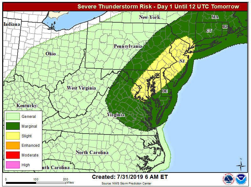
Another severe weather and heavy rain event will unfold this afternoon in portions of the Mid Atlantic, bringing another round of hazardous weather to a region that has seen plenty in recent weeks. Due to the threats, the National Weather Service has issued Flash Flood Watches for portions of Pennsylvania and New Jersey, including the Philadelphia area. Later today, Severe Thunderstorm Warnings may become necessary as storms turn severe.
A cold front moving into the region is responsible for the bad weather. A surface trough will act as a focus for showers and thunderstorms to develop by this afternoon, which will intensify as the cold front and strengthening short wave and vorticity impulse approach from the west. Conditions will become ripe for severe weather, especially from Washington, DC to New York City, NY along the I-95 corridor, with the most severe weather chances over Maryland, Delaware, and New Jersey. While there’s always a slight risk of an isolated tornado, the primary threat from today’s storms will be damaging wind gusts. The other concern today will be the threat for heavy rainfall. Precipitable water values are forecast to increase to 1.75-2.00 inches across this region by this afternoon when the thunderstorms are forecast to develop. This should lead to some efficient rainfall producing thunderstorms. With the weak flow aloft, some storms could be very slow moving initially. As such, thunderstorms could develop along the urbanized I-95/I-295 corridor and dump 1-2 inches of rain, with localized amounts of 3-4″, in a very short window of only 2-3 hours. This could lead to flash flood conditions including in urban areas.
The National Weather Service reminds people: “Turn around, don’t drown. Never drive through flood waters.”
Temperatures today are forecast to be several degrees cooler than the last couple of days, so even though dewpoints will be higher across this region, heat index values will again remain below advisory levels for today.