A powerful frontal system that’ll bring heavy lake effect snow to Upstate New York is also forecast to bring the threat of severe weather to portions of the Mid Atlantic later tonight. The same system will usher in much colder air into the northeast on strong, gusty winds, prompting the National Weather Service to issue wind advisories for many.
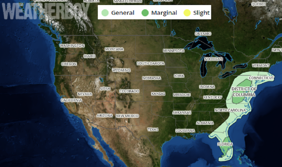
According to the National Weather Service’s Storm Prediction Center, showers and isolated thunderstorms may contribute to the potential for locally damaging wind gusts tonight across parts of the Mid Atlantic coast region. In the latest Convective Outlook Update from the Storm Prediction Center, the greatest risk of severe weather is over southeastern Pennsylvania, Delaware, eastern Maryland, northeastern Virginia, and much of New Jersey.
While the biggest threat from these storms will be damaging wind gusts, an isolated tornado or two can’t be ruled out. Because the worst of the storms could hit between 1 and 4am, people are asked to make sure they have a way to hear and act on any severe thunderstorm or tornado warning that could be issued during hours usually meant for sleeping.
While the severe weather threat will quickly diminish in the hours before and around sunrise tomorrow, gusty winds will persist throughout the northeast tomorrow. While potent winds will lead to blowing and drifting of snow in the lake effect snow bands, strong wind gusts over a broader area could knock down branches and power lines and toss around any outdoor objects not properly secured. Winds could gust to or over 50mph at times tomorrow, prompting the National Weather Service to issue wind advisories for some impacted counties. Areas under a Blizzard Warning are also assumed to have wind advisory related wing gusts tonight into tomorrow.
Don’t be that duck!#TornadoWatch #TornadoWarning #Tornado pic.twitter.com/hFRBeodcv6
— the Weatherboy (@theWeatherboy) April 15, 2019
