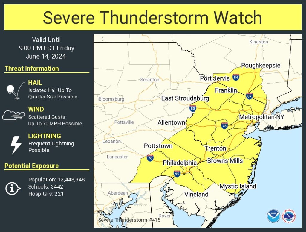
A Severe Thunderstorm Watch has been issued for portions of New Jersey, Pennsylvania, and New York due to expected storms forecast to move through the area in the coming hours. The Severe Thunderstorm Watch is in effect through 9pm tonight.
An area of strong showers and thunderstorms is moving from west to east into the Lehigh Valley and Southern Poconos now. Some of the heavier showers or thunderstorms will be capable of producing locally gusty winds to around 40 mph and small hail. Local downpours can also occur resulting in some brief minor flooding. The National Weather Service has already issued some Flash Flood Warnings due to some of the heavier showers included in this row of storms moving through. The National Weather Service warns, “Do not drive your vehicle through flooded roadways.
According to the National Weather Service’ Storm Prediction Center, recent visible satellite imagery shows cloud cover remains prevalent across parts of the Northeast and Mid-Atlantic ahead of a cold front. While this will delay and mute daytime heating to some extent, especially with northward extent into New England, filtered diurnal heating and less cloud cover southward into the Mid-Atlantic is supporting modest atmospheric destabilization. As such, thunderstorms are expected to gradually increase in coverage and intensity across these areas this afternoon as the front continues eastward in tandem with a mid/upper-level trough over eastern Canada. Occasional damaging winds should be the primary threat with any clusters or short line segments that can develop. Isolated hail may also occur with initially more discrete activity. This activity is forecast to spread eastward through the
afternoon and early evening, before eventually weakening and/or reaching the coast.
