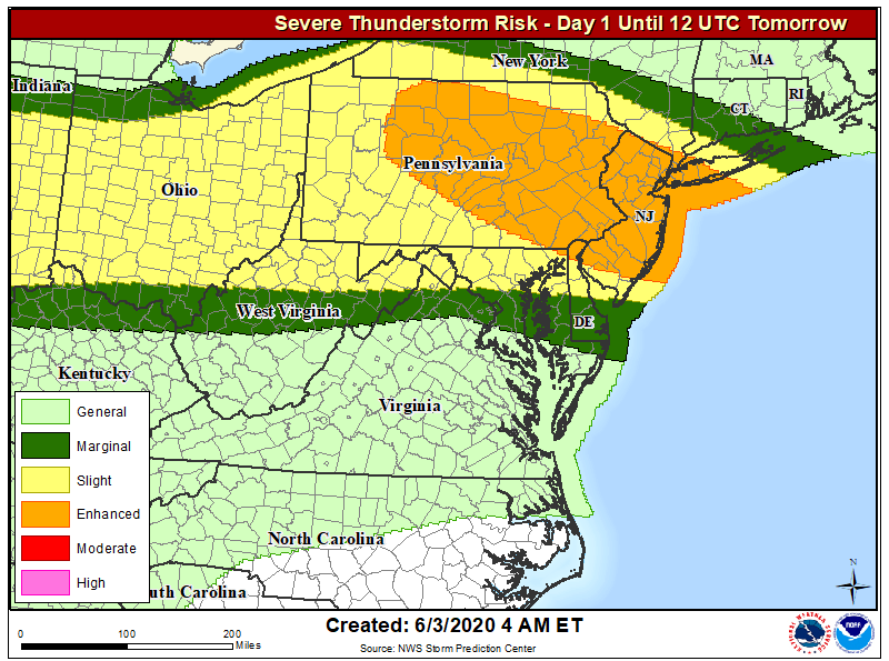
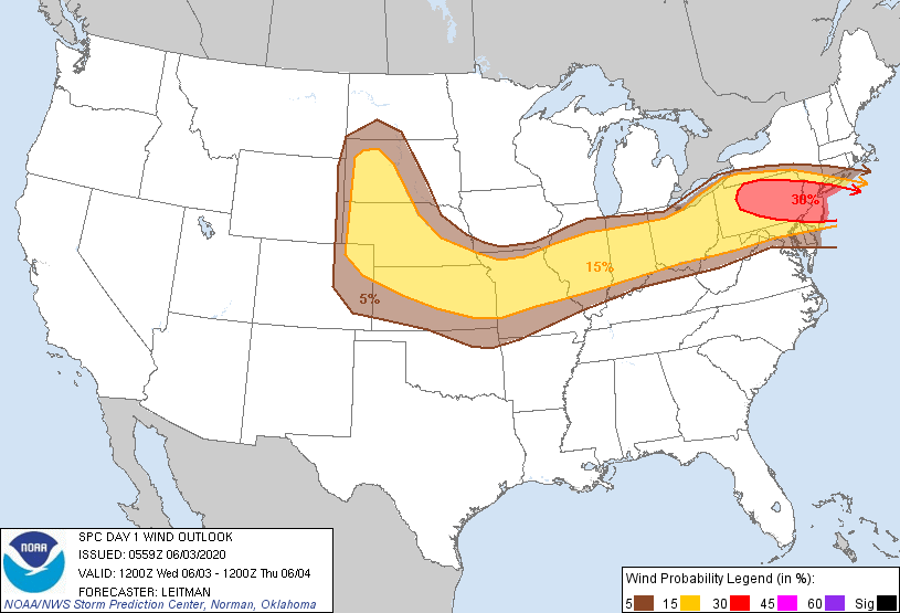
The National Weather Service’s Storm Prediction Center has upgraded the language in their latest Convective Outlook to reflect increased chances that a severe weather event will unfold today across portions of the Mid Atlantic. While damaging hail and isolated tornadoes are possible, the greatest threat is likely to be from destructive wind gusts forecast to move through the area within thunderstorm cells.
Storms are expected to develop in the vicinity of Lake Erie by late morning today as a cold front develops near the US-Canada international border. A variety of ingredients coming together will help set the stage for an eventful afternoon and evening for many populated areas within the Mid Atlantic. Ahead of the front, dewpoints in the low to mid 60’s will be maintained on southwesterly low level flow. Beyond the moist air, seasonally warm temperatures in the 70s to low 80s will support atmospheric instability to drive thunderstorm development. Fast midlevel flow will be in place across the region with strong winds flying above the surface; as thunderstorms move through, they’ll tap into these winds and drive them close to the surface, creating a wind damage threat for many.
The National Weather Service’s Storm Prediction Center says that bowing segments of thunderstorms tracking east and southeast across portions of northern and eastern Pennsylvania and into New Jersey and the New York City metro area is likely during the afternoon and evening hours, creating a situation where a damaging wind event could unfold. The National Weather Service also warns that the thermodynamic and kinematic parameter space indicates the possibility of large, severe hail in this area too. As with other severe weather outbreaks, the risk of tornadoes is also present.
As the evening continues, a more stable air mass will move into the region, ending the severe thunderstorm threat.
