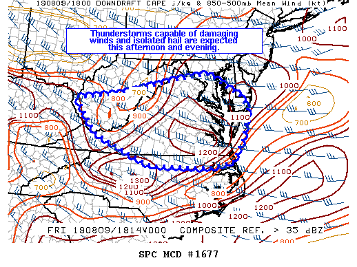
Another bout of severe weather is likely for the Mid Atlantic this afternoon and evening, especially over portions of Virginia, West Virginia, Maryland, Delaware, and North Carolina. Thunderstorms capable of damaging winds and isolated large hail are expected this afternoon and evening, prompting the National Weather Service to consider issuing a severe thunderstorm watch.
Thunderstorms have formed in southern West Virginia in an area of increased confluence and greater instability. Storms are currently in a region with a cooler and more moist boundary layer, but once storms move off the higher terrain and into central Virginia, the air mass is much hotter with steep low-level lapse rates. According to the Storm Prediction Center, the damaging wind threat is expected to increase as storms move into this region. One or two storm clusters may form and move quickly to the southeast. While isolated large hail is possible, the limited instability and modest mid-level lapse rates should limit the hail threat.
Even if a Severe Thunderstorm Watch isn’t issued, people should take shelter if even a non-severe storm forms. The National Weather Service warns, “If thunder is close enough to be heard, lightning is close enough to kill.”
