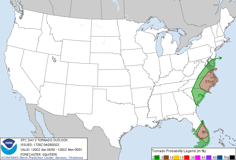
Portions of the U.S. East Coast will see a severe weather threat return on Sunday, including the risk of isolated tornadoes across portions of the Mid Atlantic from southern New Jersey south into southern South Carolina, as well as portions of east central and southeast Florida. The National Weather Service’s Storm Prediction Center (SPC) says damaging winds and a few tornadoes will be the primary hazards, though isolated hail will also be possible.
According to the SPC, a mid-level trough will eject into the Atlantic Ocean as a surface low deepens while traversing the Atlantic Seaboard. Before the surface cold front trailing the low moves offshore, adequate low-level moisture advection and veering and strengthening tropospheric winds ahead of the front will create an area ripe for thunderstorm development across portions of the Carolina Piedmont and southern Mid Atlantic and central and southern portions of the Florida Peninsula.
In their latest Convective Outlook update, the SPC says damaging wind gusts and a couple of tornadoes are possible with the stronger discrete/semi discrete supercells or line segments that can materialize during the late morning and early afternoon hours. They add that later in the afternoon, enough insolation and boundary-layer modification behind the first round of convection may support additional storm development ahead of the cold front.
“While a tornado cannot be ruled out with this second round of storms, damaging gusts may be a relatively greater concern as the northward departure of the surface low will result in straighter hodographs compared to earlier in the day,” the SPC warns.
Some severe threat may continue to spread northward in tandem with the surface low into the Mid Atlantic. However, accompanying buoyancy should be scant and the severe risk is expected to be isolated, with a damaging gust or tornado possible.
In central and south Florida, a mix of line segments and semi-discrete supercells may pose a damaging gust or tornado threat before the cold front moves offshore.
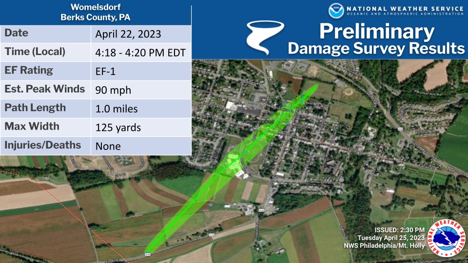
This weekend’s severe weather threat arrives after last weekend’s. Among the tornadoes to touch down was an EF-1 tornado which struck southeastern Pennsylvania on Saturday.
