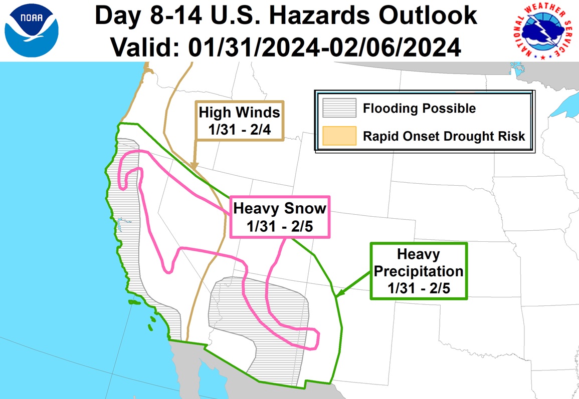
A significant atmospheric river event is forecast to blast into California in the coming days, dumping more heavy snow in the mountains and heavy flood-causing rains elsewhere. Portions of southern California are recovering from record rainfall in recent days and forecast rains could bring widespread flood concerns state-wide.
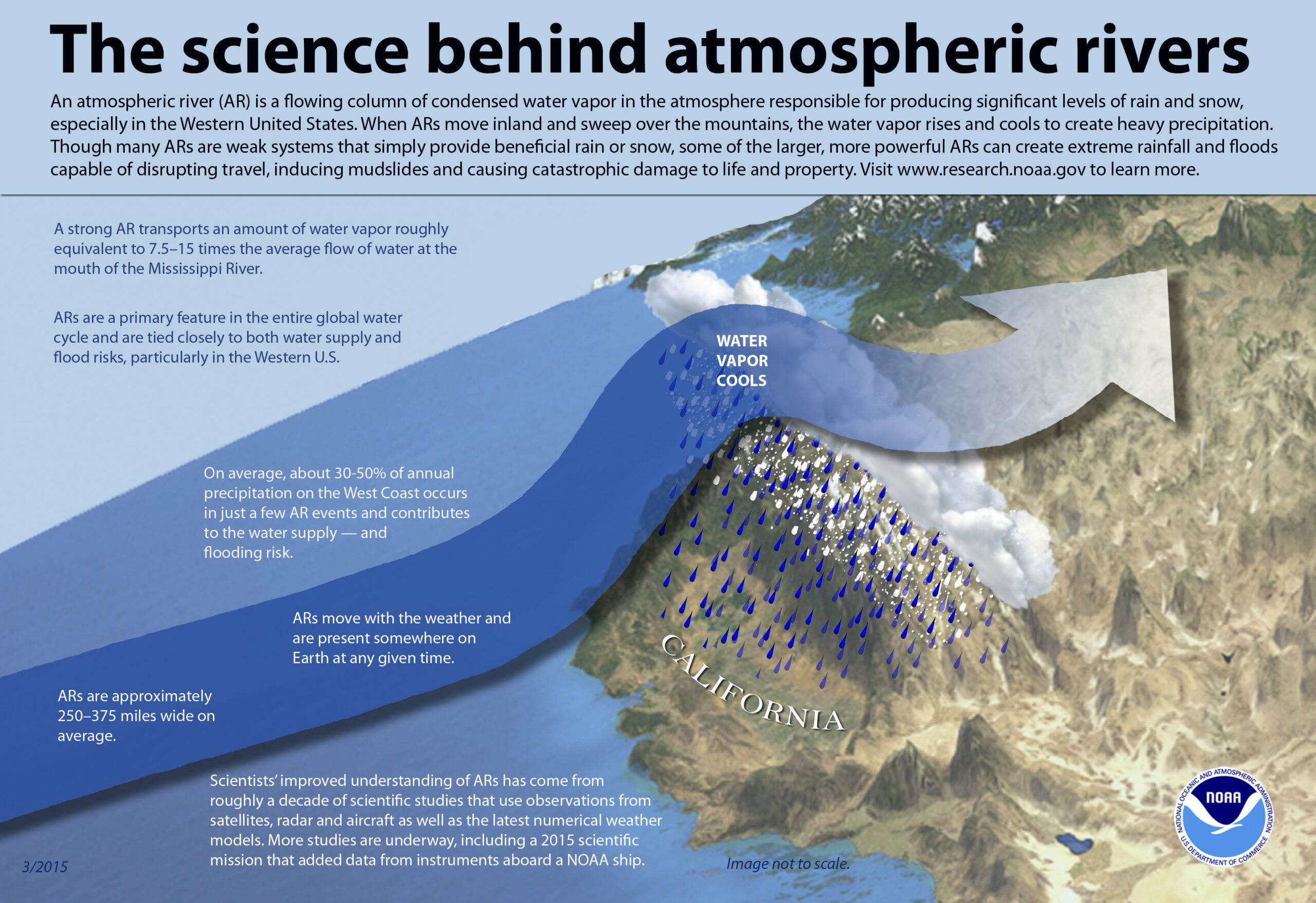
An atmospheric river refers to a narrow stream of concentrated moisture in the atmosphere. The most common atmospheric river event is nick-named “Pineapple Express”; in this type of situation, a robust stream of moisture near the Hawaiian islands flows north and east into western North America, dropping copious amounts of rain and snow as it interacts with the terrain there.
Unfortunately, a fresh atmospheric river event will bring more widespread flooding to California in the coming days; Los Angeles could see some big problems next round! #CAwx https://t.co/vv5CkrEzwh
— the Weatherboy (@theWeatherboy) January 23, 2024
These long, narrow atmospheric rivers help transport moisture from the tropics, in water vapor form, to areas far from the tropics. The liquid equivalent of these moisture plumes could be comparable to the water flowing through the mouth of the Mississippi River, according to NOAA.
On average, 30-50% of annual precipitation on the U.S. West Coast occurs from a few atmospheric river events. In addition to replenishing water supplies, they can also create problems associated with heavy precipitation: flooding, rock/mud slides, and avalanche dangers.

As the stream of water vapor hits the mountain ranges over the U.S. west coast, the air rises, cools, and condenses the moisture out of it. This condensed moisture falls out of the sky as heavy rain, heavy snow, or both.
A significant atmospheric river event is expected to unfold in the coming days, with the worst arriving in the first days of February.
During this next atmospheric river event, there is a moderate risk of heavy precipitation across most of California and coastal portions of the Pacific Northwest from January 30 to February 3, with a high risk across California January 30 – February 2 which can lead to localized flooding and landslides.
The higher elevations of the northern Sierra Nevada and Klamath Range are expected to receive very heavy snow; snow levels are forecast to drop as the event unfolds.
Dangerously high onshore winds are also likely to impact the west coast at this time which could lead to coastal erosion from persistently high waves.
The heavy precipitation is also forecast to fall over areas that had previous burn scars from earlier wildfires. When heavy rain hits those scars, mudslides and debris flows may also happen, creating additional hazards on area roads and in regional communities.
The west coast won’t be the only place seeing very heavy precipitation moving-in in the coming days! https://t.co/hpWOU8FsKr
— the Weatherboy (@theWeatherboy) January 23, 2024