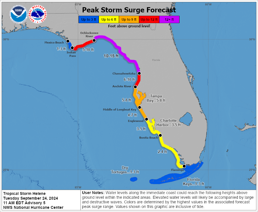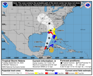
A significant, potentially catastrophic storm surge is expected along portions of the Florida Gulf Coast as Helene, forecast to be a major hurricane at landfall, advances closer to the Sunshine State. The National Hurricane Center (NHC) says that a storm surge of up to 10-15 feet is possible along Florida’s “big bend” area between Ochlockonee River and Chassahowitzka; a significant storm surge is also possible from as far west as Mexico Beach to as far south as the Florida Keys.
Due to the threat from storm surge, the National Hurricane Center has issued Storm Surge Warnings for for large parts of the Florida Gulf Coast. Specifically, the Storm Surge Warning is up from Flamingo to Indian Pass including all of Tampa Bay and Charlotte Harbor.
A Hurricane Warning is also in effect from the Anclote River to Mexico Beach in Florida.
Right now, Helene is a tropical storm located roughly 155 miles east-southeast of Cozumel, Mexico. It is about 150 miles south of the western tip of Cuba. Maximum sustained winds are up to 50 mph while the minimum central pressure is down to 995 mb or 29.39″. Helene is forecast by the NHC to intensify and be near hurricane strength when it passes near the northeastern coast of the Yucatan Peninsula on Wednesday, where a Hurricane Warning is also in effect.

Beyond there, Helene is expected to rapidly intensify and grow in size over the eastern Gulf of Mexico. There is a danger of life-threatening
storm surge along the entire west coast of the Florida Peninsula and Florida Big Bend. The highest inundation levels are expected along the coast of the Florida Big Bend.
“Residents in those areas should follow advice given by local officials and evacuate if told to do so,” warns the National Hurricane Center. They add, “Damaging hurricane-force winds are expected along portions of coast of the Florida Big Bend, where a Hurricane Warning is now in effect. Preparations to protect life and property should be complete by early Thursday since tropical storm conditions are expected to begin within this area on Thursday.”
Helene will bring heavy rain to portions of the western Caribbean with potentially significant flooding and mudslides across western Cuba. Considerable flash and urban flooding is expected across portions of Florida, the Southeast, southern Appalachians, and the Tennessee Valley Wednesday through Friday. This includes the risk of landslides across the southern Appalachians. Widespread minor to moderate river flooding is likely, and isolated major river flooding is possible.