
A significant tornado outbreak is likely across large portions of the eastern U.S. today. The National Weather Service’s Storm Prediction Center has been busy issuing Tornado Watches for a very wide area stretching from central Florida through southern and central Georgia, central South and North Carolina, much of Virginia, eastern Maryland, much of south-central and eastern Pennsylvania, all of Delaware, and most of New Jersey.
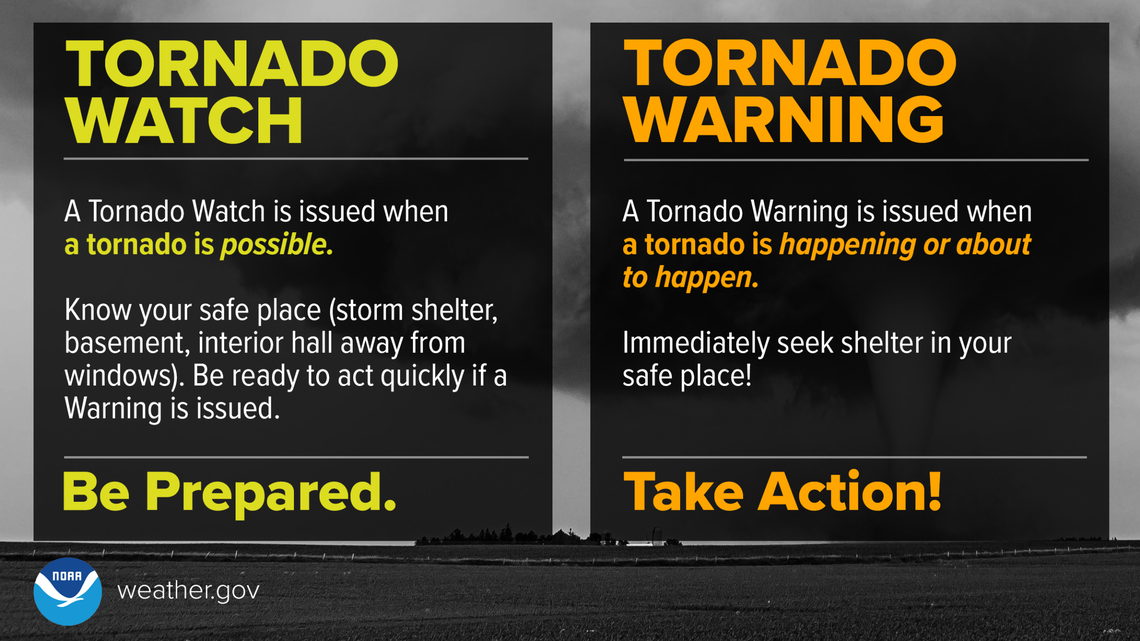
A Tornado Watch means weather conditions are favorable for tornadoes, requiring you to be prepared and monitor updates, whereas a Tornado Warning means a tornado has been sighted or indicated by radar, requiring immediate, life-saving shelter action.
In a bulletin sent to people in New Jersey, Delaware, Maryland, and Pennsylvania, the Storm Prediction Center wrote, “A Tornado Watch means conditions are favorable for tornadoes and severe thunderstorms in and close to the watch area. Persons in these areas should be on the lookout for threatening weather conditions and listen for later statements and possible warnings.”
Fast moving thunderstorms may become widespread and accompanied by the risk for damaging wind gusts and a few tornadoes across the Mid Atlantic today. There is potential that a couple of storms could become capable of producing strong and long track tornadoes. An intense upper trough continues to deepen over the Mid Mississippi Valley, with its associated surface cold front surging eastward across the Appalachians and into the Carolinas/Mid-Atlantic. An active line of thunderstorms is accompanying the front from Georgia into western South and North Carolina and Virginia. Low-level winds are very strong along and ahead of these storms, encouraging the risk of numerous severe wind gusts and embedded tornadoes along the line. Clusters of thunderstorms have been developing ahead of the line as well, in a moist and strongly sheared environment. The Storm Prediction Center (SPC) says that these storms will also pose a severe/tornado risk through the day as the primary large-scale ascent arrives.
Farther north, low-level moisture is a little more limited and the amount of atmospheric energy that could translate into tornadic thunderstorms is a bit lower. Nevertheless, intense low and mid level wind fields will be present across this region as the cold front approaches from the west. Thunderstorms are expected to strengthen through the late morning across west-central Virginia into central New York/Pennsylvania and spread eastward to the coast by early evening. Forecast soundings across this area show very large low-level shear values that will favor the risk of widespread damaging winds and several tornadoes. Strong tornadoes will be possible – especially from Maryland southward where the greatest low-level moisture will be present.
The SPC is warning that there could also be severe tornadoes in Pennsylvania and New Jersey. The SPC says there could be “swaths of damaging winds (60-80 mph) and a few tornadoes with embedded circulations” adding that a couple of strong tornadoes (EF2) will be possible. Tornadoes are rated on the Enhanced Fujita (EF) Scale.; this scale classifies tornadoes into the following categories based on their sustained windspeeds: EF0: 65 to 85 mph, EF1: 86 to 110 mph, EF2: 111 to 135 mph, EF3: 136 to 165 mph, EF4: 166 to 200 mph, and EF5: >200 mph.
In the wake of the main convection, secondary cyclogenesis is forecast to occur late this afternoon along the cold front over Virginia and Maryland. The initial storms will remove most of the low-level moisture and atmospheric instability, but the SPC says that the extreme intensity of the low-level winds fields and large-scale forcing could result in a secondary risk of damaging winds from low-topped showers and thunderstorms after dark. This threat could spread northeastward into eastern Pennsylvania and New Jersey and perhaps southern New England this evening.
Beyond the tornado threat, severe thunderstorms today will feature an abundance of lightning and heavy downpours that could trigger flash flooding. Damaging hail and destructive wind gusts are also possible too, with structures being threatened by the rotating winds of a tornado and/or the straight-line blast of winds associated with a thunderstorm.
