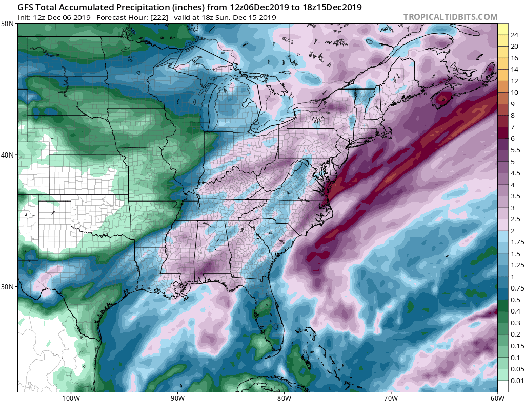
A very wet weather pattern will bring a lot of soaking rain to much of the eastern United States over the next week and a half.
The first rain-maker will arrive on Monday, Tuesday, and Wednesday next week, bringing light to moderate rain as a frontal system moves through. As cold air fills in behind the system, some of that rain could end as snow from Washington, DC to Boston, MA, although it’s still too soon to say if such a changeover would occur and who would see how much snow. For now, it appears if a changeover to snow does occur, it’d be more likely to be light than heavy.
A more significant storm around December 14, with a potent coastal low pressure system projected to form off the southeast coast and move north. Without much cold air to work with, it’s likely that most precipitation from this storm will fall as rain, even as far north as the U.S./Canadian border. Rain with this system could be heavy at times, especially in the coastal plain. Strong winds and rough surf could also present additional problems of beach erosion and coastal flooding.
A colder weather pattern should unfold after that mid-December system. A colder pattern could translate to more snow chances before Christmas, but it’s still too early to say with certainty who will see a White Christmas this year.