A strong cold front will chill-down portions of the Eastern U.S. on Saturday; a weak weather system forming along that front will likely bring snow showers, flurries, and light accumulation to portions of Mid Atlantic on Sunday. Unlike previous storms this winter, snowfall will not be significant and major disruptions to travel are not expected. However, because even a light coating of snow on untreated surfaces can be problematic, people are urged to exercise caution in the wintry weather.
An upper-level trough from the Great Lakes to the lower Mississippi Valley Saturday night is forecast to shift east and arrive in the Mid Atlantic by Sunday. Arriving in the wake of a strong cold front, temperatures will be sharply colder Saturday night into the early part of the new week. Low pressure is forecast to develop along the sharpening baroclinic zone off the lower Mid-Atlantic coast late Saturday night and Sunday, helping kick-off some wintry precipitation. However, due to a progressive flow across the region and the surface low tracking well-off shore, precipitation will be limited on land. Should the system become a bit more amplified or develop closer to the coast, more considerable snowfall is possible; but for now, odds of that happening are low.
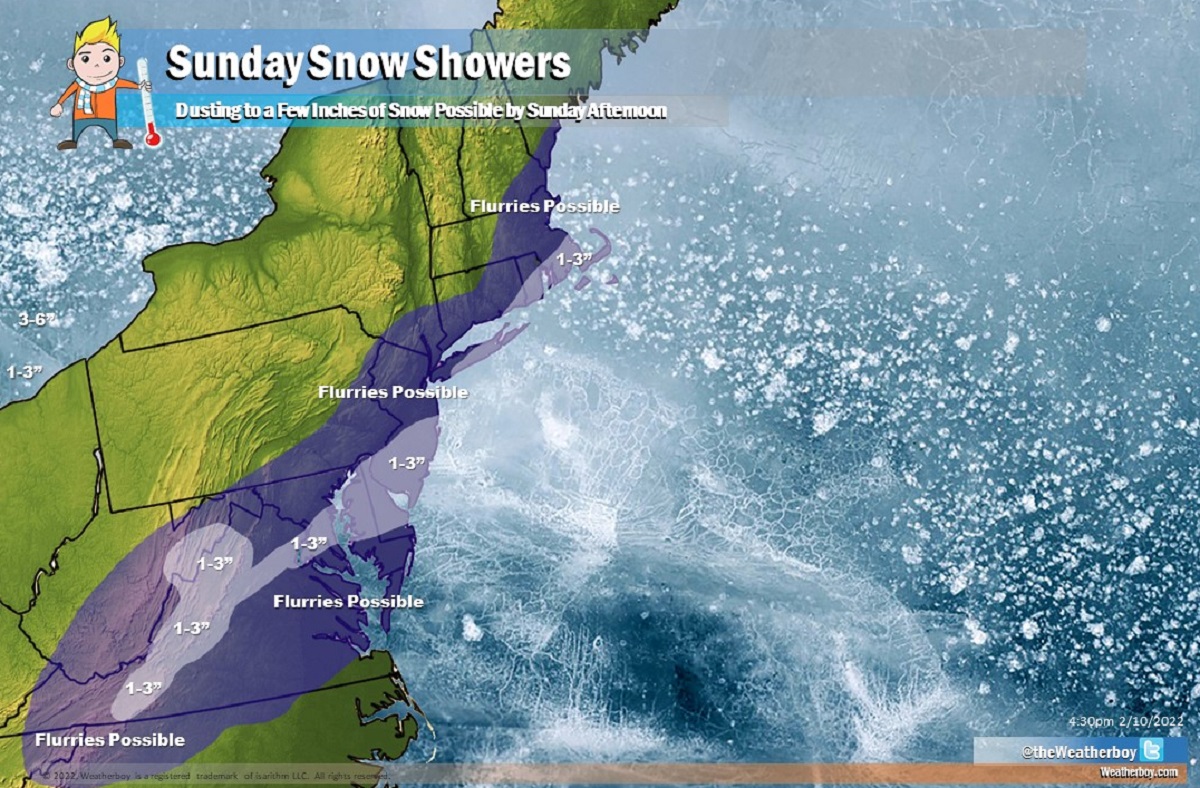
Snow showers and snow flurries are possible from northern North Carolina north and east through much of Virginia and Maryland, all of Delaware, Rhode Island, and New Jersey, easternmost Pennsylvania, southeastern New York, and southeastern portions of Connecticut and Massachusetts. These snow showers and flurries will start in the overnight hours Saturday night into Sunday morning; this light snow should exit the region by lunchtime on Sunday. Some flurries could coat the ground with a dusting of snow.
There’s also a risk of snow accumulating beyond a dusting, although not much more, across portions of Virginia, Maryland, Delaware, New Jersey, Long Island, Rhode Island, and southeastern Massachusetts. In these areas, snow of up to an inch or two is possible. Over the highest terrain of western Virginia, it’s possible some isolated 3-4″ amounts could fall, but overall this will be a very light, low-impact snow event in the eastern U.S.
Precipitation will quickly exit the coast Sunday afternoon, with fair and dry conditions building into the entire region by Sunday evening.
