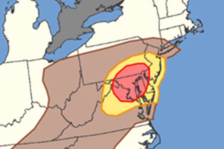
For the third day in a row, severe thunderstorms with destructive winds are forecast to blast through portions of the Mid Atlantic later today and this evening. After two nights of down trees, wires, and widespread power outages, the National Weather Service’s Storm Prediction Center (SPC) says scattered wind damage is possible with thunderstorms across the Mid-Atlantic this afternoon and evening.
Early morning surface analysis places a low pressure system over northwest Ohio, along a diffuse west to east oriented cold front extending from Iowa through Pennsylvania and New Jersey. The forecast calls for this low to gradually shift eastward just ahead of slow-moving shortwave trough. Thunderstorm development is anticipated in the vicinity of this low as well as along the cold front, forced predominantly by low-level convergence, across the Upper Ohio Valley. Lapse rates will be poor, but warm and moist surface conditions will still support modest buoyancy and the potential for strong updrafts. Vertical shear is weak so storm organization will be limited, but a few bowing segments are still
possible given the potential for strong cold pools.
The SPC says that the highest likelihood for a few stronger gusts will be across eastern Pennsylvania and New Jersey where slightly stronger mid-level flow exists.
Modest lee troughing is expected from central Maryland southwestward through the Carolina Piedmont. Diurnal airmass destabilization is anticipated in the vicinity of this troughing, supported by very warm and moist conditions with temperatures in the upper 90s and dewpoints in the upper 60s to low 70s. Afternoon thunderstorms are expected along this troughing, with moderate to strong buoyancy supporting strong updrafts and potential water loading. The SPC says that vertical shear will be weak, so the expectation is for outflow dominant multicell storms to merge into clusters or line segments.
Meteorologists at the SPC are keeping an eye on part of the atmosphere known as the Planetary Boundary Layer or PBL for short. The PBL is the lowest part of the troposphere, extending from the Earth’s surface to about 1,000 meters. Here, wind is heavily slowed by surface friction, and rapid vertical mixing and turbulence continuously exchange heat, moisture, and pollutants between the ground and the atmosphere
“The hot, well-mixed PBL and resultant, steep low-level lapse rates will enhance the damaging wind potential from mid afternoon into evening,” warns the SPC. “Damaging wind potential is expected to be more sporadic with southward extent into the Carolinas owing to more limited storm coverage.”
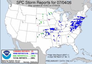
The Fourth of July was full of Mother Nature’s own fireworks, with 985 severe weather events recorded by the National Weather Service. Most of those severe weather events were wind related, most of which were across Pennsylvania, New Jersey, Maryland, Virginia, and Delaware.
More than 100,000 people in New Jersey alone were without power as of the publication time of this article. Severe storms have battered the Mid Atlantic for the last two evenings, putting hundreds of thousands in the dark and without air conditioning across the region.
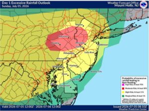
In addition to damaging winds, including an isolated tornado threat, and frequent lightning, these severe storms may also drop copious amounts of rain over a short amount of time. These downpours could create flash flood conditions, prompting the National Weather Service to issue Flood Watches for New Jersey and portions of Pennsylvania, New York, and Connecticut. The greatest threat of flooding rains will be over eastern Pennsylvania and northern New Jersey; here, rain could fall in excess of 2″/hour.
“Turn around, don’t drown! Never drive through flood waters,” warns the National Weather Service.
