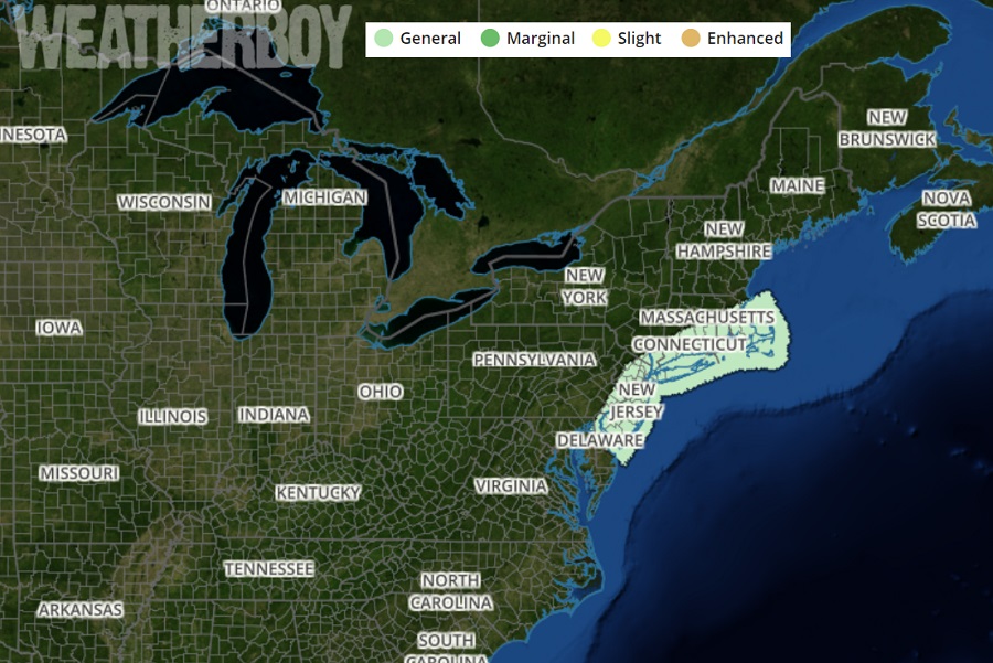
The storm system responsible for some midweek mayhem in portions of the Mid Atlantic and Northeast has the potential to trigger strong thunderstorms. The National Weather Service’s Storm Prediction Center has now shaded in a region on their latest Convective Outlook over New Jersey, New York City, Long Island, Connecticut, Rhode Island, and eastern Massachusetts.
Thunder snowstorms in this region will bring many hazards with them: exceptionally heavy snowfall rates of 2-3″/hr or greater, gusty winds, and frequent lightning. The advice from the National Weather Service holds true in any season: “when thunder roars, head indoors.” Even in cold weather conditions, lightning can be deadly.
The thunderstorm activity will blossom during a phase of rapid intensification of today’s well advertised snowstorm. The expected explosive growth of the storm during the afternoon will produce numerous convective cells, all which have the potential to create life-threatening weather conditions in the isolated areas they impact. Thunderstorms also have the potential to rob moisture from nearby communities; as an example, a thunder snowstorm in Edison, New Jersey which would dump locally heavier amounts there could rob nearby New Brunswick and Woodbridge of some of its accumulating snow. As a result of this convective activity, snow amounts may be several inches greater/less over extremely short distances. Similar things happen in warmer weather months: isolated thunderstorms could create very localized flash flooding in one town while adjacent towns remain dry.
The threat of thunderstorms is greatest between 1pm and 8pm today. As the storm moves northeast and evolves from one that is explosively developing to one that is simply mature or decaying, the threat of convection will fade.
