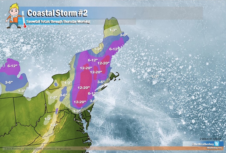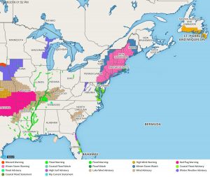
The National Weather Service has upgraded Winter Storm Watches to Winter Storm Warnings, with a large area expecting at least 6″ of snow in places like Philadelphia, PA, New York City, NY, and Boston, MA. With rain and/or sleet mixing in at times along the southern and eastern edges of this storm, snow totals will be drastically less along and to the south and east of the I-95 corridor.

In New Jersey, the accumulation drop-off will be quite sharp near the New Jersey Turnpike. Along and to the north and west of the Turnpike, and along and to the north of I-195 in central New Jersey, 6″ or more of snow is expected. However, just south and east, snowfall amounts will drastically drop, with no accumulation expected at the south Jersey Shore communities, Cape May County, and the Atlantic City area. The same milder air near the ocean that will keep accumulations out of southernmost New Jersey will also keep snow away from easternmost Long Island, extreme southeastern Rhode Island, and southeastern Massachusetts.
While a small state, Delaware too will see sharp drops in accumulations from north to south. In the most northern part of the state, a foot of snow is possible; slightly south, near Lewes, no accumulating snow is expected. Maryland will also see drastic changes in snowfall accumulations in the northeastern part of the state. While Baltimore will see a light slushy coating, areas near Rising Sun and Oakwood could see nearly a foot.
The “jackpot zone” for the heaviest snow will be in areas hit hard by the last nor’easter: eastern Pennsylvania and especially the Poconos, where 12-20″ is expected. More than a foot of snow is also expected in portions of eastern Upstate New York, southern Vermont and New Hampshire, and western and central Massachusetts.
Snow moves in tonight from southwest to northeast, with the heaviest snow expected Wednesday afternoon and early evening. Snow will be extremely heavy at times, with 2-4″/hour rates possible in the areas expecting the heaviest snow. Thunder snowstorms are also expected; remember: when lightning roars, head indoors. Lightning can kill even when it is snowing. The snow activity will taper off late Wednesday; however, lingering snow showers will persist around the Great Lakes and northern New England on Thursday morning.
Beyond heavy wet snow, there will be strong, gusty winds. Some winds may gust up to 40mph at times; such winds will stress weakened trees and wires from the last storm, perhaps triggering additional extended power outages. Gusty winds will also lead to rough surf and coastal erosion. While minor to moderate coastal flooding is possible from this storm, it won’t be nearly as bad as it was over the weekend from the last storm.
Once this nor’easter exits the coast, attention will be paid to a new system that could bring a fresh round of problems to the Mid Atlantic and/or Northeast early next week.