Residents in the northeast should brace for another day of severe weather today. Strong to severe thunderstorms are likely from the northern Mid Atlantic into central New England; an isolated tornado or two is also possible here.
Strong to severe storms capable of hail and strong wind gusts are expected across portions of the central and southern High Plains. Additional severe storms capable of primarily damaging winds are expected across portions of the Northeastern and Mid-Atlantic region Sunday afternoon and evening.

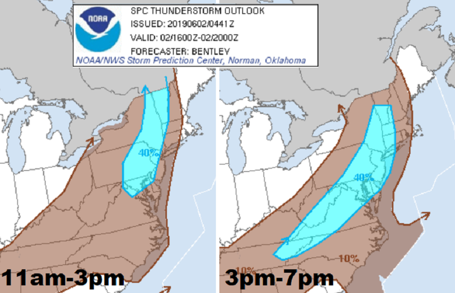
In the northeast, a variety of meteorological ingredients are coming together to create severe weather. A strong upper level jet stream is forecast to dig southeast across Wisconsin and then move to near the base of Great Lakes and then onward to New England by tonight. In response to this feature, a surface low is expected to deepen which will encourage a surface front to surge east during the day. Latest computer forecast model guidance suggests a wind shift will occur from central New York into central Pennsylvania around lunchtime today. Pronounced boundary-layer heating is forecast ahead of the wind shift which will allow for appreciable air mass destabilization as far north as the lower Hudson River Valley. Convection may be ongoing along the front at day break Sunday across southern Ontario into the Ohio Valley and extensive cloudiness should limit buoyancy farther north near the Canadian border. However, further south, especially into eastern upstate New York, eastern Pennsylvania, and most of New Jersey, severe cells could fire up. Organized line segments and multi-cell updrafts will be the most common storm mode today, with locally damaging winds being the primary risk. There is a slight chance some cells could be tornadic. although the best chance for tornadic conditions is over the Hudson Valley of New York State south into northern and central New Jersey.
Once these storms push through the region, fair conditions are forecast to return. The new week will feature much cooler and drier conditions to start with, with warmer, more humid conditions returning for the second half of the week. Along with the increased heat and humidity will be an increasing chance for more rain showers and thunderstorms.
