Florida is coming off of one of its warmest Decembers ever and people are wondering: why doesn’t it get too cold in Florida, especially the southern part of the state? And a question we often get: does Miami ever get snow?
Florida is primarily characterized as a humid subtropical climate which means the summers are hot and humid with winters being somewhat cool and humid. The southern parts of the Florida peninsula can be characterized as a savanna or monsoon with a defined wet and dry season. This type of climate is typical in lower latitudes near large bodies of water. The wet or rainy season in Florida begins in May and lasts through October. Aside from a tropical wave or cyclone the rainy season sees air mass thunderstorms that develop with daytime heating and along sea breeze fronts. Brief but heavy rainfall is common with these types of slow moving thunderstorms that generate and dissipate in a relatively short period of time. The dry season develops in mid to late October and will last until April. During the dry season the average low temperature in Miami, FL will only drop to 60 degrees which occurs mostly during the month of January. Along with the lack of daily thunderstorms it is also possible for cold fronts associated with mid latitude storms to push south through the entire state of Florida. Typically these bring a brief chill by Florida standards but given the right weather pattern, can bring freezing temperatures and wintry weather as far south as Miami, Fl. One such cold snap in January of 1977 was responsible for reports of snowfall in Miami-Dade County with another as recently as 2010 pushed the temperature below freezing over much of the state.
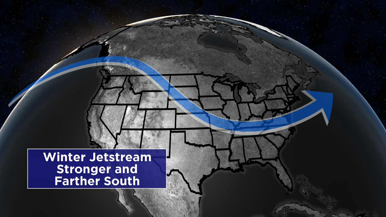
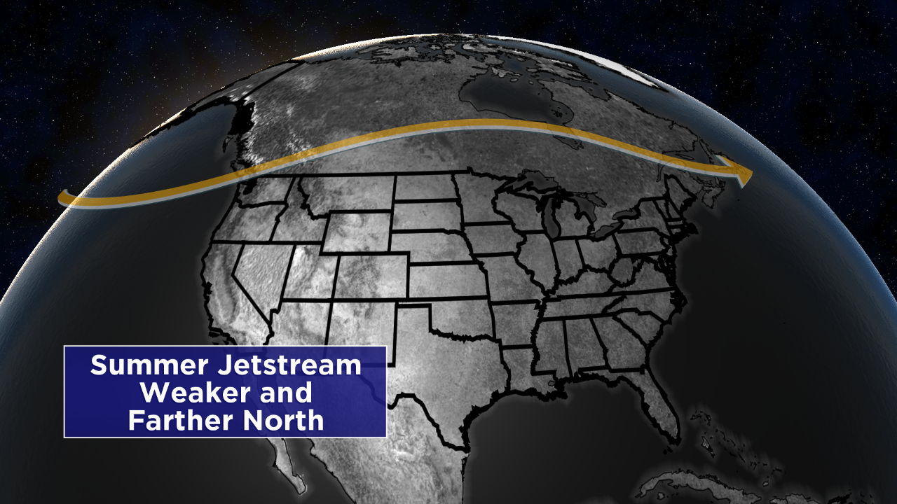
The jet stream is a fast moving current of air thousands of feet in the air and is located along the boundary between very warm air near the equator and colder air near the poles. In the northern hemisphere the jet stream typically flows from west to east and is a major dynamical force in developing storms over the mid latitudes. During the summer months this temperature difference in the Northern Hemisphere is not as extreme as in the winter. The North pole receives a good amount of the Sun’s radiation and in some cases will see 24 hours of daylight. This warming, at the pole and the lower latitudes will create less of a temperature contrast than the winter month’s when the pole receives little to no daylight at all. There are still storms in the summer time but with this weaker temperature contrast and the storms tracking farther north, cold fronts associated with these storms often stall out and dissipate well north of Florida. Increase this temperature contrast and move these storms farther south then these cold fronts have enough energy to track through Florida and in some cases make it all the way into the Caribbean.
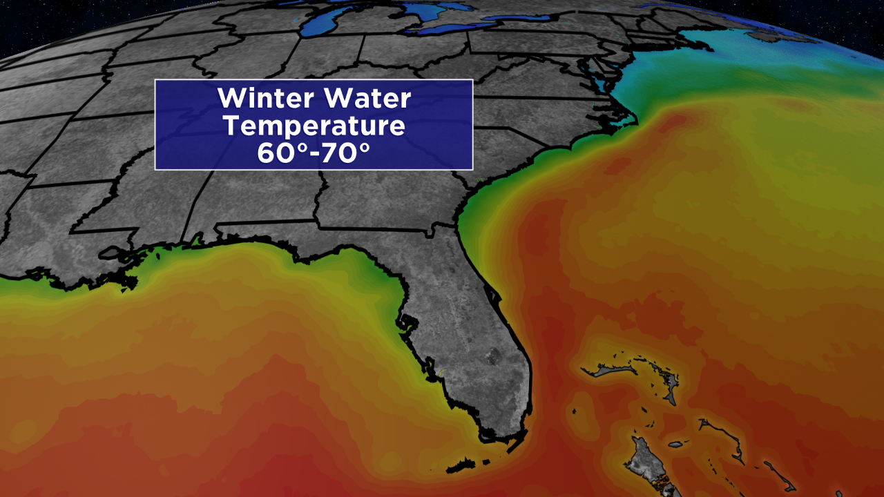
A cold front itself is not enough to send much of the Florida into a deep freeze. On either side of the Florida Peninsula is a very warm body of water compared to the air temperature you may find behind a strong cold front. The Atlantic Gulf Stream hugs the east coast of the state which can keep the water temperature between 60 and 70 degrees even in the coldest months of the year. The Gulf Coast may be slightly cooler but can still keep the temperatures relatively mild just along the coast in all but the most extreme cold cases. In order to negate the warm ocean’s impact or temperature over land the wind must be coming down the peninsula, remain over land and then flow off the coast over the water. This is called drainage flow and can bring very cold and dry air that originates in the Arctic down the peninsula and give even South Florida freezing temperatures.
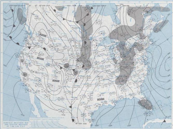
With every singe extreme cold snap in Florida you will find an area of high pressure that builds in behind the passing cold front and settles over the eastern parts of the southern plains. This will create a north to slightly northwest wind and keep the cold dry air behind the cold front over land, keeping it cold and dry as it moves down the entire state. Depending on how quickly this type of pattern evolves can determine the extent of the cold air outbreak in the state. With each passing day the wind may diminish and the sun and ocean will work to warm the temperature. Cold snaps don’t last long relative to what the northern United States may experience, but it does not take long to devastate a citrus crop. A hard freeze is with the temperature drops to 28 degrees F, something that certainly can occur when the conditions are right.
