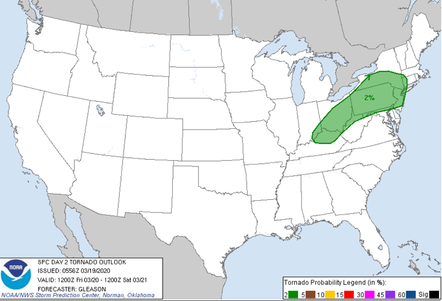
According to the National Weather Service’s Storm Prediction Center, severe thunderstorms are expected from the lower Missouri Valley and the Ozarks vicinity into the middle Mississippi and lower Ohio Valleys today. Damaging gusts, isolated large hail and tornadoes are possible; isolated strong to severe storms capable of producing mainly wind damage may occur Friday across parts of the Ohio Valley into the Mid-Atlantic and Northeast. While the greatest threat of severe storm damage is from straight-line winds, a threat of tornadic cells also exists on Friday across northern Kentucky, eastern Ohio, southern Upstate New York, and most of Pennsylvania and New Jersey.
A positively tilted upper trough over the Ohio Valley and Great Lakes Friday morning will shift northeastward across parts of the Mid-Atlantic and Northeast through the the next 24 hours. A surface cold front will sweep quickly eastward across these regions during the day today. Flow through the low and mid levels is forecast to be quite strong along and ahead of a cold front as the upper trough ejects northeastward. These conditions could support severe to potentially violent weather during the afternoon.
According to the National Weather Service’s Storm Prediction Center, surface dewpoints ahead of the front, coupled with modest diurnal heating, may be enough to support a threat for strong, gusty winds with isolated damage with any storms that can strengthen along or ahead the front through the afternoon and early evening. A tornado or two also cannot be ruled out with any storm embedded within the line. However, low-level flow should have a tendency to veer to west-southwesterly through the afternoon as the low-level jet shifts northward, which should gradually reduce effective the threat of tornadic activity late Friday.
Regardless of shelter-in-place and quarantine restrictions associated with the COVID-19 Pandemic, people should remain weather-aware and storm ready. Before the threat of severe weather arrives, people should identify where they’d seek safe shelter in the home, building, or place-of-safety that they find themselves in during this pandemic. Should a Severe Thunderstorm Watch or Warning and/or a Tornado Watch or Warning be issued, it is imperative people know what to do should severe weather strike.
