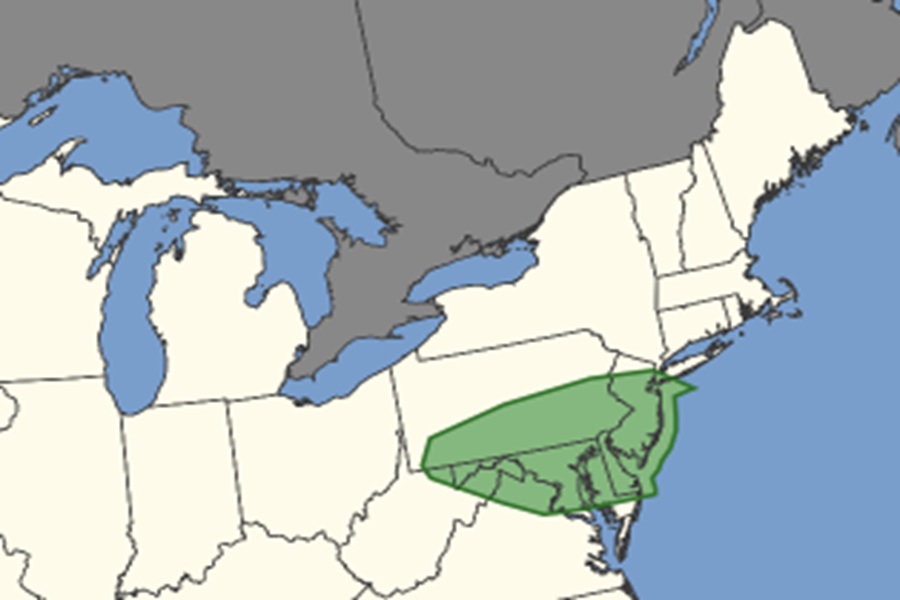
A threat of tornadic thunderstorms is growing over portions of the Mid Atlantic today, especially over New Jersey, Delaware, much of Maryland, southern and eastern Pennsylvania, far eastern West Virginia, and northern Virginia. According to the National Weather Service’s Storm Prediction Center (SPC), scattered severe thunderstorms capable of producing damaging winds and perhaps a couple of tornadoes should occur this afternoon and evening across portions of the Mid-Atlantic into the Southeast. Scattered severe thunderstorms are also expected across the northern and central High Plains, with large to very large hail the main threat there.
A relatively fast zonal flow is present today from the Ohio Valley into the Mid-Atlantic and Northeast U.S, with a shortwave trough moving through Michigan and Ohio. As this feature tracks eastward, it will push a surface cold front southward across the central Appalachians and into the Mid-Atlantic region.
“Given the relatively strong winds aloft and dewpoints in the 60s, it would seem likely that scattered strong to severe storms will occur, capable of locally damaging winds and perhaps a tornado,” said the SPC in their latest Convective Outlook.
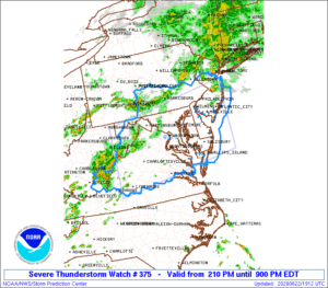
Due to the threat of severe weather, the Storm Prediction Center issued a Severe Thunderstorm Watch for southern New Jersey, all of Delaware, much of Maryland, southeast Pennsylvania, and much of Virginia. This area could feature storms with destructive wind gusts, large, damaging hail, and isolated tornadoes.
