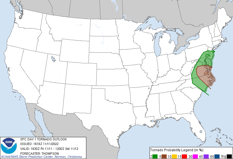
While Hurricane Nicole has deteriorated to a tropical depression, atmospheric motion associated with it is helping to spin-up numerous tornadoes along the coastal plain of the Mid Atlantic. While Nicole’s remnants spread north, the threat of isolated tornadic cells will spread north today into tonight. The elevated risk of tornadoes today into tonight stretches from north-central New Jersey and southeastern Pennsylvania south to the North Carolina / South Carolina border; the greatest risk is over southeastern Virginia and eastern North Carolina, including the Outer Banks.
The remnants of Nicole will accelerate northeastward and weaken by tonight over the Mid-Atlantic, setting the stage for some rough weather in the coastal plain. According to the National Weather Service’s Storm Prediction Center, the potential exists for broken convective bands from North Carolina into Virginia through the afternoon as some low-level destabilization occurs in cloud
breaks. Conditions will be ripe northeast of the remnant circulation center of Nicole today, with a couple of tornadoes possible with supercells in the convective bands.
The National Weather Service cautions that the tornado threat well northeast of Nicole’s center is expected to expand considerably northward and inland today as Nicole accelerates into the western Carolinas, and its outer convective bands interact with a broadly
destabilizing air mass.
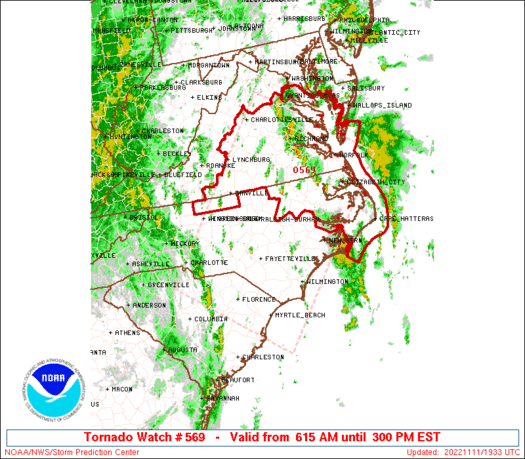
Due to this threat, a Tornado Watch has been issued along with several Tornado Warnings. A Tornado Watch means conditions are favorable for tornadoes and severe thunderstorms in and close to the watch area. Persons in these areas should be on the lookout for threatening weather conditions and listen for later statements and possible warnings. Tornado Warnings are issued when a tornado has been spotted by a trained spotter and/or observed through weather RADAR imagery and analysis. When a Tornado Warning is issued, you may only have moments to act to get to a place of safe shelter where you are.
The threat of tornadic cells will dissipate late tonight as what’s left of Nicole and a frontal system moving through the northeast clears the region of any severe weather threat.
