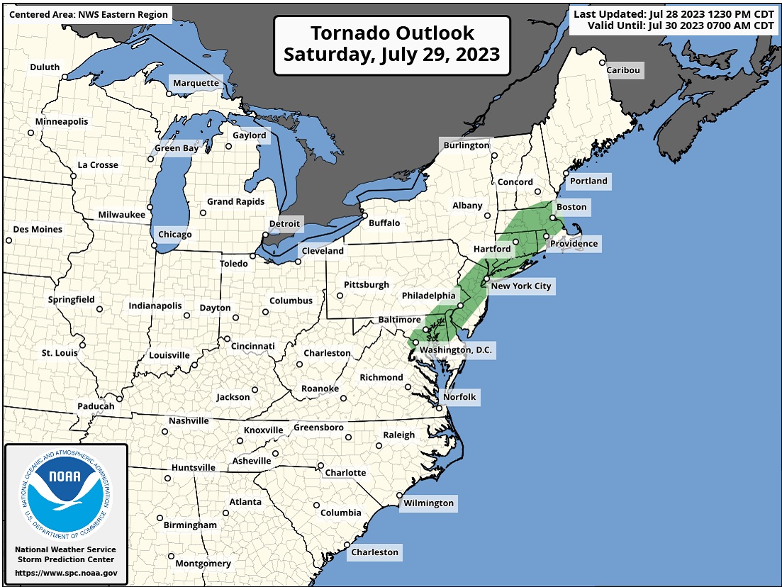
In what continues to be a hyperactive severe weather season, yet another threat of tornadic thunderstorms will be returning to the I-95 corridor tomorrow, with the area stretching from Washington, DC to Boston, Massachussetts under the gun for an elevated tornado threat. Other areas included in the threat zone include Baltimore, much of eastern Maryland, northern Delaware, southeastern Pennsylvania including Philadelphia, much of New Jersey, the entire New York City metro area and nearby portions of Long Island and southeastern New York state, Hartford and most of Connecticut, Providence and much of Rhode Island, and most of central and eastern Massachussetts. This zone of an enhanced tornado threat is within a broader area that will be threatened by severe thunderstorms which will also contain large hail and damaging wind gust threats.
According to the National Weather Service’s Storm Prediction Center (SPC), widely scattered to scattered strong to severe thunderstorms are possible over southern New England into the Mid Atlantic states on Saturday. Damaging gusts are the primary hazard. According to the SPC, the upper-level ridge centered over the Divide today will amplify on Saturday while some amplification of the cyclonic flow aloft over the Northeast is also expected; at the surface, a frontal boundary will continue to sag southward within the Plains into the Northeast.
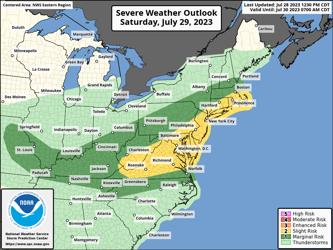
Widely scattered to scattered storms are expected to develop by afternoon either along the front or along a surface trough near the Blue Ridge. Despite modest mid-level lapse rates, strong surface heating and a very moist boundary layer will support moderate unstable atmospheric conditions across central and eastern Virginia into perhaps the Delmarva. Farther north, more limited heating and weaker mid-level lapse rates will limit overall destabilization. With the amplifying upper-level pattern, moderate mid-level winds will exist as far south as the northern Mid-Atlantic and decrease fairly rapidly to the south. The SPC says that given the degree of buoyancy, damaging downburst winds are the expected primary threat with isolated large hail possible with initial storm development.
To make matters more complicated, a mesoscale convective vortex will be moving out of the Great Lakes region into the northeast. According to the SPC, depending on where this feature is located, an area of greater mesoscale shear and storm coverage could develop around the Mid Atlantic.
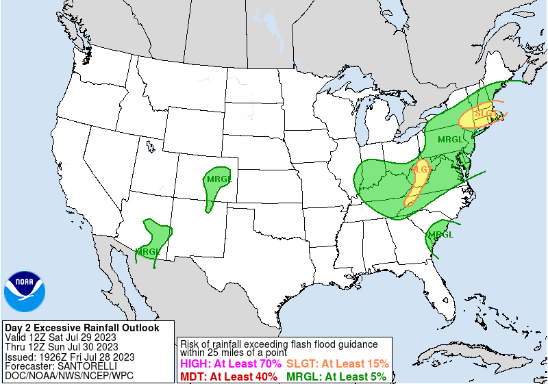
In addition to the threat of severe storms, there is also a threat of flooding rains from soaking storms. Some heavy rain could create isolated flood and flash flood situations. The National Weather Service reminds people in impacted areas to “turn around, don’t drown” and “never drive through flood waters.”
