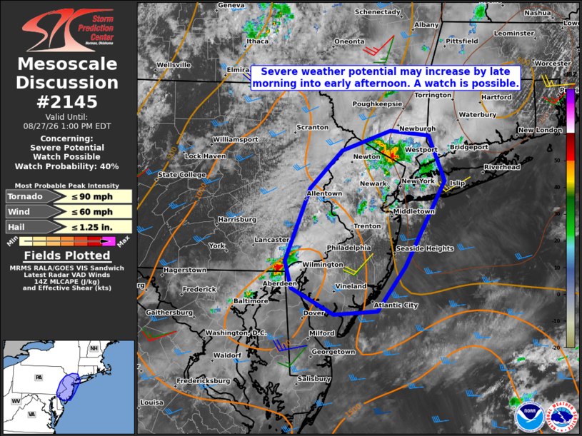
The National Weather Service’s Storm Prediction Center is warning that severe weather is likely in portions of the northeast today, with an elevated threat for tornadoes for some and a threat of damaging winds and large hail for many others. Today’s threat arrives a week after another tornado outbreak, in which 6 tornadoes were confirmed to touch down in New Jersey, Delaware, Maryland, and Pennsylvania last Thursday.

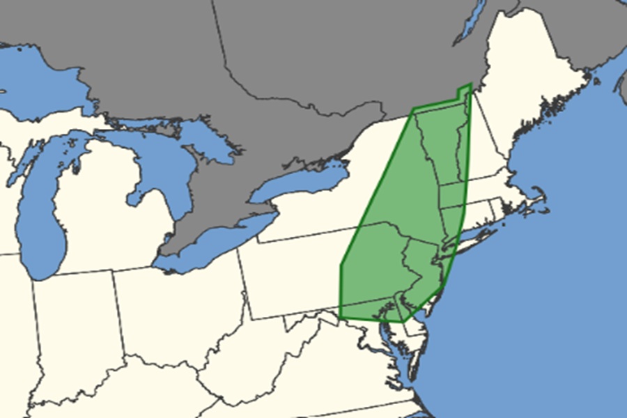
Today, the greatest threat of tornadoes exist over most of New Jersey, northeastern Maryland, northern Delaware, eastern Pennsylvania, eastern New York, all of Vermont, portions of western New Hampshire and Massachussetts, and northwestern Connecticut. The cities of Philadelphia and New York City are contained within this risk area.
A variety of atmospheric ingredients are coming together today to make a situation ripe for severe weather. An elongated mid/upper-level trough with a closed low over Hudson Bay will encompass much of the eastern US today. Embedded within this large-scale troughing, a mid-level shortwave trough with modestly enhanced southwesterly winds will advance
northeastward through the day across the Mid-Atlantic and Northeast. At the surface, a weak low over eastern Ontario will develop into Quebec this afternoon, with a trailing cold front advancing southeastward across the Mid-Atlantic and Northeast. According to the Storm Prediction Center (SPC), stronger daytime heating is forecast with southward extent across the Mid-Atlantic ahead of the cold front, with cloud cover potentially limiting heating somewhat across the Northeast. Even so, the SPC says that a zone of moderate instability should develop by this afternoon across these regions, with sufficient deep-layer shear for some thunderstorm updraft organization. Current expectations are for thunderstorms to
gradually increase in coverage and intensity later today ahead of the surface front and a lee trough along/east of the Appalachians.

The SPC says that a mix of multicells and supercells should pose a threat for both severe hail and damaging winds, especially from the northern Mid-Atlantic northward into New York and vicinity. A tornado or two may also occur, with modest hodograph curvature noted in various forecast soundings from northern Maryland northeastward to western New England.