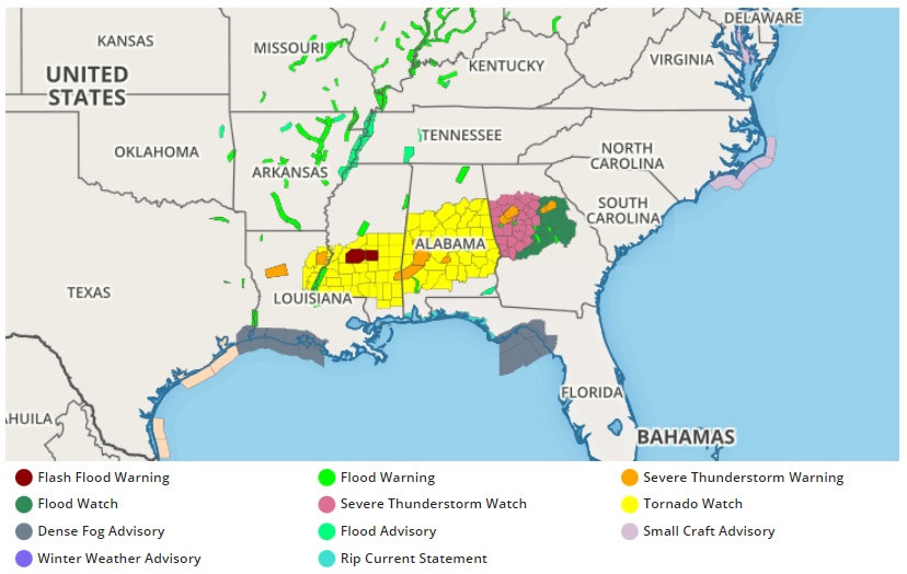
Another round of severe weather is impacting portions of the southeast yet again today, prompting the National Weather Service to issue numerous watches and warnings across portions of Louisiana, Mississippi, Alabama, and Georgia. Tornado Watches have been posted from east central Louisiana across southern Mississippi and much of central Alabama. Severe Thunderstorm Watches are up for portions of Georgia, including the Atlanta metro area. Within these watches are Tornado Warnings and Severe Thunderstorm Warnings which are issued as storms impact specific counties and parishes.
According to the National Weather Service’s Storm Prediction Center (SPC), clusters of storms, including both left- and right-moving supercells, will likely persist for the next several hours with an attendant threat for large hail up to 2″ in diameter. The potential for damaging winds and a tornado or two will increase some later tonight, as storm clusters move eastward from Alabama into western Georgia.
The SPC also warns that a locally favorable corridor for supercell tornadoes may be developing over portions of south-central Alabama (near and just south of Montgomery) into the evening hours.
The latest surface observations and radar/satellite imagery indicate a remnant outflow boundary extending east/southeastward from near/south of Montgomery, Alabama into southeast Alabama. Through this corridor, dewpoints remain in the mid to upper 60s while surface winds are relatively backed. Observations also show a modest increase in low-level flow, and further strengthening should yield larger, clockwise-turning low-level hodographs with time. This means the tornado threat will persist for several more hours; tornadoes could be large, strong, and move along long tracks on the ground.
