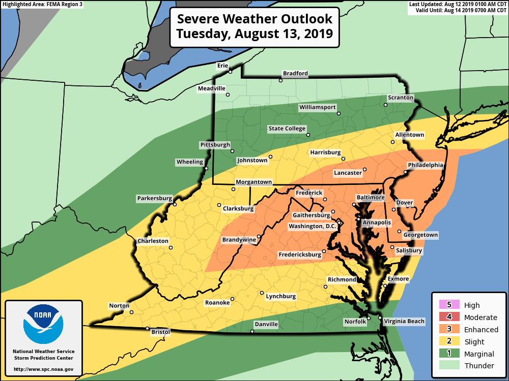
Meteorological ingredients appear to be coming together to create yet another violent weather event in portions in the Mid Atlantic where many have been seen in recent months. As an example, last Wednesday alone saw storms generate three tornadoes in New Jersey. Severe thunderstorms with damaging wind gusts, large hail, and isolated tornadoes are possible throughout the Mid Atlantic, with the greatest threat over western West Virginia, central and eastern Maryland, northern Virginia, all of Delaware, southeastern Pennsylvania, and central and southern New Jersey. The severe weather is expected to arrive in this region during the afternoon and early evening hours tomorrow.
Due to the higher than normal odds of a severe weather event, the National Weather Service’s Storm Prediction Center has issued a Convective Outlook that puts this area under an “Enhanced” threat level. This means that numerous severe thunderstorms are possible; they’ll be more persistent and/or widespread, with a few storms reaching intense levels. The National Weather Service defines a severe thunderstorm as a storm with measured wind gusts to at least 58 mph and/or hail to at least 1″ in diameter and/or the presence of a tornado. All thunderstorms, whether they’re severe or not, could contain very heavy rain which could create floods; they can also create frequent lightning. The National Weather Service warns, “when thunder is close enough to be heard, lightning is close enough to kill.”
With severe weather likely, the National Weather Service will issue Severe Thunderstorm or Tornado Watches for the region tomorrow. Once a severe cell or a tornado forms, they will issue warnings for impacted or soon-to-be-impacted counties. It is important for people in this region to know what county(s) they’re planning to be in/around Tuesday and have a plan of what to do when they’re there or enroute to an area under a Tornado Warning or a Severe Thunderstorm Warning.
