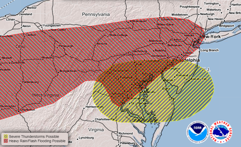
Two types of bad weather will visit portions of the Mid Atlantic later this afternoon and evening: flash flooding heavy rains and severe thunderstorms.
A recent wet weather pattern has many creeks, streams, and rivers in the region already running full. Additional rain from today’s heavy showers could push some waterways out of their banks, flooding some communities. Heavy downpours could also impact highways and urban areas, leading to isolated cases of flash flooding.
While heavy rain is a concern, so are severe thunderstorms. Increasing towering cumulus clouds and a few showers have already formed over the higher terrain of western Virginia. The formation of these clouds and showers is is likely due to daytime heating and atmospheric destabilization, and according to the National Weather Service’s Storm Prediction Center, possibly aided by a mesoscale convective vortex that is noted by model data over southwestern Pennsylvania and and western Maryland. It is likely that that this activity will intensify this afternoon and spread eastward towards Delaware, eastern Maryland, and northeastern Virginia. With a belt of moderately strong mid-level winds extending over this area together with surface temperatures approaching 90F, it appears that the strongest clusters of storms could produce locally damaging wind gusts. While a widespread tornado event is unlikely, some straight-line wind gusts from severe thunderstorms could produce damage comparable to EF0 and EF1 tornadoes. The northern extent of the severe weather area will be associated with persistent clouds and more stable air over Pennsylvania while the southern extent will be associated with decreasing deep layer shear over southern Virginia.
The wet weather is in no hurry to leave. Unsettled conditions with showers and storms are likely to remain all week, clearing out by late Friday as high pressure returns to the area. With more showers and storms likely this week, severe weather and flood threats could linger too.