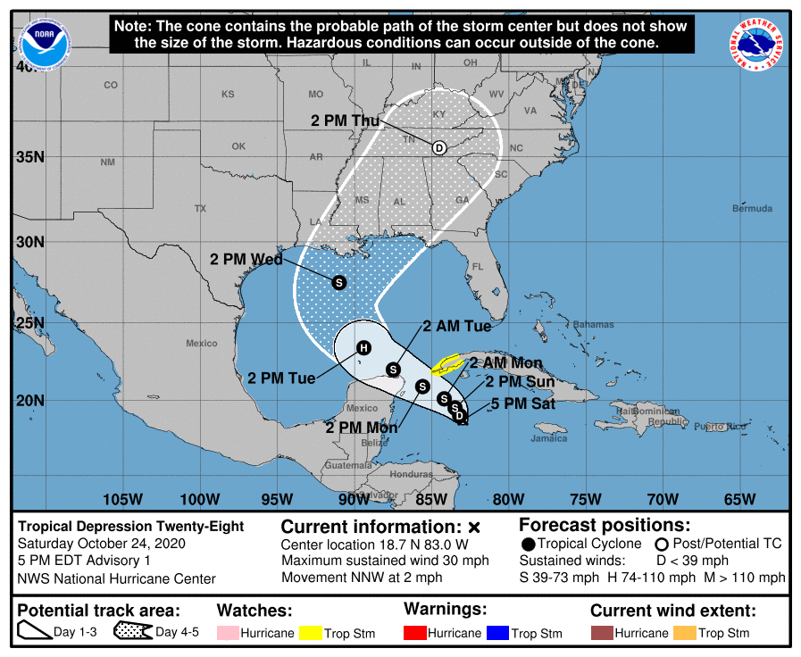
The National Hurricane Center (NHC) has classified the disturbance moving through the Caribbean as Tropical Depression #28. The Tropical Depression is expected to evolve into a Tropical Storm; once it reaches tropical storm strength, it will be given the name Zeta. The NHC also forecasts Zeta to intensify further into a hurricane as it moves into the central Gulf of Mexico.
Due to the forecast, the government of Cuba has issued a Tropical Storm Watch for the province of Pinar del Rio. A Tropical Storm Watch means that tropical storm conditions are possible within the watch area, generally within 48 hours.
In the latest update from the National Hurricane Center, the center of Tropical Depression Twenty-Eight was located near latitude 18.7 North, longitude 83.0 West which places it roughly 280 miles east-southeast of Cozumel, Mexico. The depression is moving toward the north-northwest near 2 mph, and this motion is expected to continue through early Sunday. The system should gradually turn toward the west-northwest with a faster forward speed by Monday. On the forecast track, the center of the depression is anticipated to remain south of Cuba tomorrow and approach the Yucatan Channel or Yucatan Peninsula late Monday before emerging into the southern Gulf of Mexico on Tuesday.
Maximum sustained winds are only near 30 mph now but the system is forecast to gain strength with time. The National Hurricane Center is forecasting slow strengthening during the next 72 hours, and the system is expected to become a tropical storm on Sunday and could become a hurricane over the southern Gulf of Mexico on Tuesday.
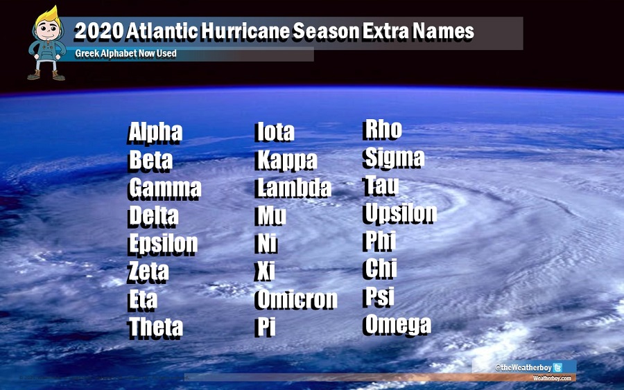
Zeta, the sixth letter of the Greek alphabet, was only used once before to label a tropical storm that formed in December of 2005. The 2020 Atlantic Hurricane season has been extremely busy, running out of names to use weeks ago. Now, letters of the Greek alphabet are being used to label tropical storms and hurricanes in the Atlantic hurricane basin.
