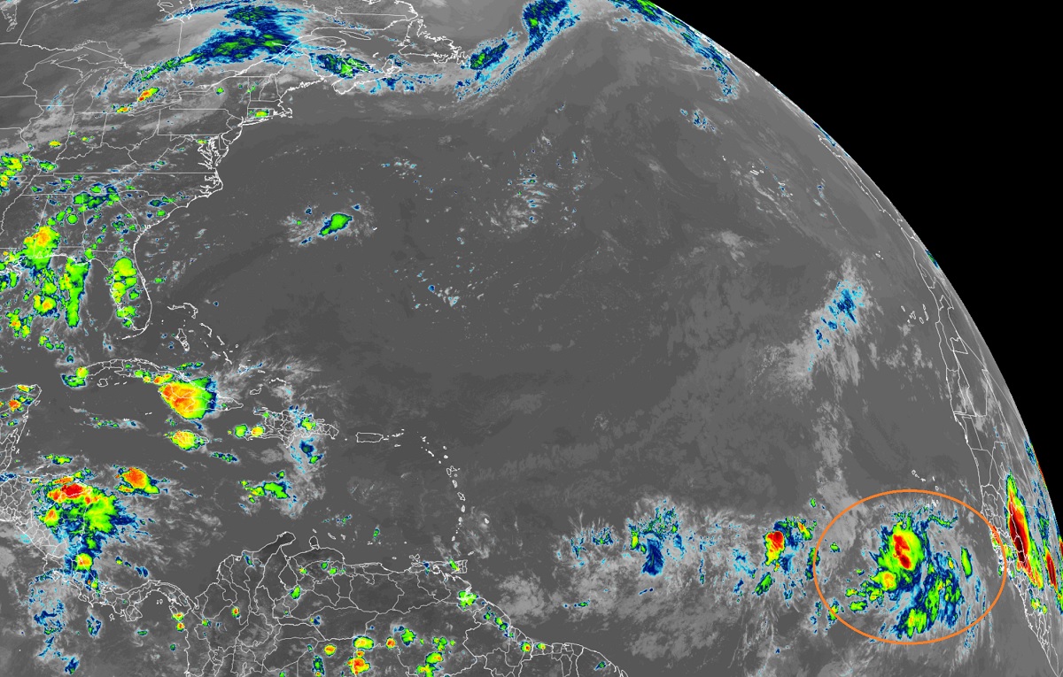
A new tropical depression is expected to form in the Atlantic Ocean this week after a lull in activity that has lasted more than a month. In this afternoon’s Tropical Outlook, the Miami, Florida-based National Hurricane Center says conditions could be conducive for a tropical depression to form. However, they also add that forecast hostile conditions in the atmosphere at the end of the week could eventually hamper development then.
The latest photography from NOAA’s GOES-East weather satellite shows an area of showers and storms taking shape north of the Equator and west of the west coast of Africa. This large area of showers and thunderstorms over the far eastern tropical Atlantic south of the Cabo Verde islands is associated with a tropical wave. According to the National Hurricane Center, this system has changed little in organization today, but environmental conditions appear conducive for gradual development over the next several days while it moves westward to west-northwestward at 15 to 20 mph across the eastern and central tropical Atlantic.
The National Hurricane Center believes that a tropical depression could form by the middle to latter portion of this week as the system moves west across the open waters of the Atlantic Ocean. However, the National Hurricane Center also says conditions are expected to become less favorable for additional strengthening by this weekend. Right now, the National Hurricane Center believes there’s a 20% chance that a tropical cyclone will form here over the next 48 hours; those odds grow to 40% over the next 5 days.
Elsewhere throughout the Atlantic Hurricane Basin, the National Hurricane Center expects no other tropical cyclones to develop anywhere for at least the next 5 days.
The 2022 Atlantic Hurricane Season runs through to the end of November.