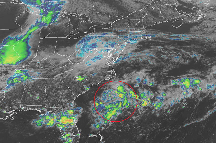
It appears a new tropical depression is forming just east of the U.S. southeast coast. The National Hurricane Center has been monitoring this area for possible tropical cyclone formation and it appears that is indeed happening now. An Air Force Hurricane Hunter aircraft is en route to the system to investigate further. This area of concern is one of four that the National Hurricane Center has been tracking since yesterday.
Based on satellite photography, the area of low pressure located about 135 miles southeast of Wilmington, North Carolina does indeed seem to be better structured. The National Hurricane Center says it is likely that a tropical depression will form here within the next 12 hours if it hasn’t yet already.
Should the system further intensify to a tropical storm, it would break the record as the earliest “N” storm on record in the Atlantic Hurricane Basin. The current record earliest 14th named storm is Nate, which formed on September 6, 2005. The next “N” storm this year would be Nana and if it forms before Sunday, the record will break.
Fortunately for the U.S., it appears the system will continue to move north and east. While it’ll parallel the coast, it shouldn’t hit it. However, rough surf and rip currents are likely along much of the coast whether or not the system takes on additional tropical characteristics.