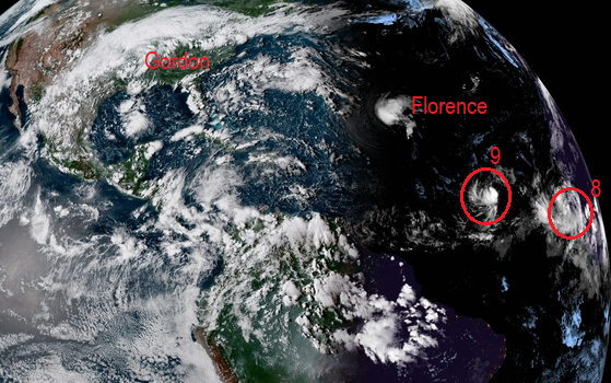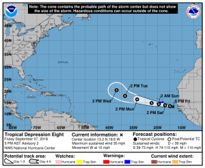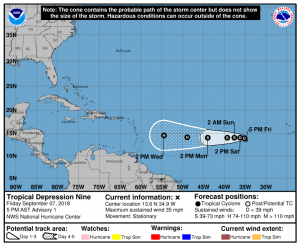
Tropical Depressions 8 and 9 have formed, with the National Hurricane Center initiating advisories on each at 5pm ET. They are both forecast to intensify over time and become Tropical Storms Helene and Isaac in the coming days.
Tropical Depression 8 has already triggered the issuance of Tropical Storm Warnings, which are in effect for Santiago, Fogo, and Brava. A Tropical Storm Warning means that tropical storm conditions are expected somewhere within the warning area within 36 hours.

As of the last update, Tropical Depression 8 was located near latitude 13.2 North, longitude 18.6 West. The depression is moving toward the west near 10 mph. A westward to west-northwestward motion with a gradual increase in forward speed is expected during the next 72 hours. On the forecast track, the disturbance is expected to move near the southern Cabo Verde Islands late Saturday night or on Sunday. Maximum sustained winds are near 35 mph with higher gusts. The National Hurricane Center is forecasting strengthening during the next three days or so, and the depression is expected to become a tropical storm tonight. The estimated minimum central pressure is 1002 mb or 29.59 inches.

Tropical Depression 9 is located further west over the central Atlantic.In the first advisories released by the National Hurricane Center, the center of Tropical Depression Nine was located near latitude 13.6 North, longitude 34.9 West. The depression is stationary and little motion is expected through tonight. The National Hurricane Center believes a westward motion with an increase in forward speed will occur this weekend and early next week. Maximum sustained winds are near 35 mph with higher gusts. Little change in strength is expected during the next 24 hours, but gradual strengthening is forecast late this weekend and early next week. The estimated minimum central pressure is 1007 mb or 29.74 inches.
It is too soon to tell whether or not either system will impact the U.S. over time.