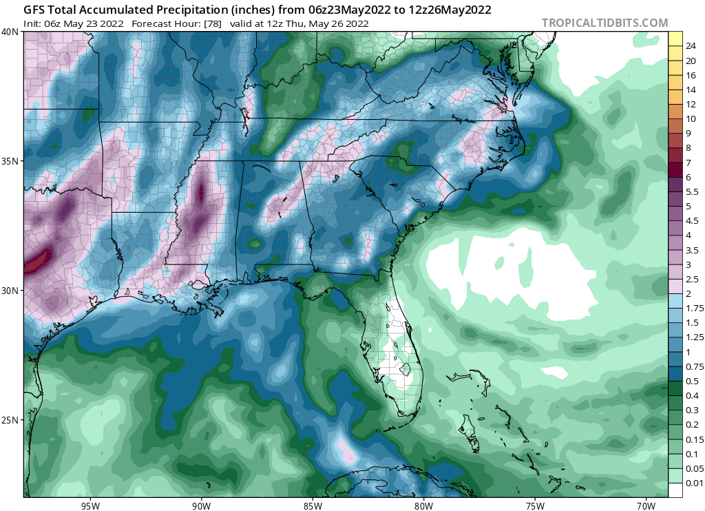
While the Atlantic Hurricane Season doesn’t officially start until June 1, the National Hurricane Center (NHC) has been monitoring a disturbance in the northern Gulf of Mexico that moved inland earlier today. Fortunately, the system has no chance of developing, but it is expected to soak portions of the southeast over the next 72 hours.
According to the latest Tropical Outlook from the NHC, the area of low pressure in question moved inland overnight along the north-central Gulf of Mexico coast and is now located over south-central Alabama. The low is expected to continue to move over land today, and tropical cyclone development is not expected. However, locally heavy rains associated with this system will continue to spread northeastward across portions of the southeastern United States over the next day or so.
According to the American GFS global computer forecast model, the rain will be heaviest over portions of eastern Louisiana, much of Mississippi, central Alabama, northern Georgia, and portions of North Carolina. As much as 3-5″ of rain could fall from this system as it moves through.
Elsewhere in the Atlantic hurricane basin, there is no area of concern and the National Hurricane Center expects no other tropical cyclone formations over the next 5 days.
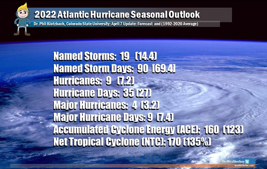
The 2022 Atlantic Hurricane Season kicks off on Wednesday, June 1, and lasts through to the end of November. In April at the 2022 National Tropical Weather Conference, meteorologists with the CSU Tropical Meteorology Project unveiled their seasonal outlook which suggests the upcoming season will feature an above normal number of tropical storms, hurricanes, and major hurricanes.
