Tropical Storm Bret formed today and is forecast by the National Hurricane Center to strengthen into a hurricane before impacting the Caribbean. Meanwhile, an impressive cluster of thunderstorms just east of Bret could also be developing into the next Atlantic Hurricane Basin’s tropical cyclone. No warnings or watches are up for Bret yet, but that could change in the coming days and people in its potential path should begin to prepare for its arrival.
Bret is forecast to strengthen and move across the Lesser Antilles as a hurricane on Thursday and Friday, bringing a
risk of flooding from heavy rainfall, hurricane-force winds, and dangerous storm surge and waves. According to the National Hurricane Center, given the larger than usual uncertainty in the track forecast, it is too early to specify the location and magnitude of where these hazards could occur. However, everyone in the Lesser Antilles, Puerto Rico, and the Virgin Islands should closely monitor updates to the forecast for Bret and have their hurricane plan in place.
As of the latest advisory from the National Hurricane Center (NHC), Bret was located at 11.3N 42.2W which is roughly 1,295 miles east of the southern Winward Islands. Maximum sustained winds are at 40 mph with higher gusts. The storm is moving to the west at 21 mph. Minimum central pressure is at 1008 mb or 29.77″.
Bret is a record-breaker: it is the farthest east that a tropical storm has formed in the Atlantic south of 23.5 N this early in the calendar year on record.
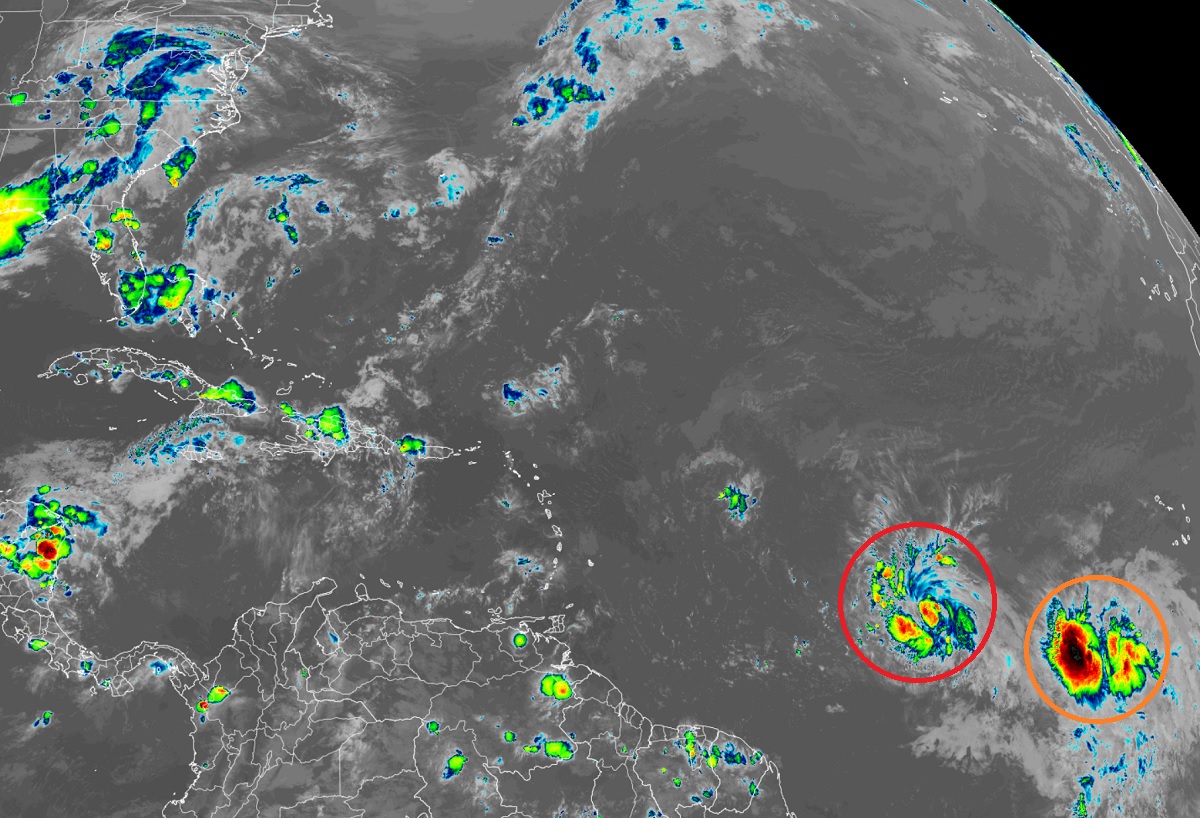
While Bret is forecast to move west and intensify, a system just to its east may do the same. The NHC is tracking a tropical wave located several hundred miles southwest of the Cabo Verde Islands, which continues to produce a large area of disorganized showers and thunderstorms. The NHC says environmental conditions appear favorable for further development of this system, and a tropical depression could form in a couple of days while the system moves westward at 10 to 15 mph across the eastern and central tropical Atlantic. Should this system strengthen to a Tropical Storm like Bret did today, it would be named Cindy. Right now, the NHC says there’s a 50-50 chance of tropical cyclone formation over the next 48 hours but those odds grow to 60% for the balance of the week.
The Atlantic Hurricane Season officially started on June 1 and runs through to the end of November.
