While Canada is dealing with the wrath of a potentially catastrophic Fiona tonight and people in the eastern United States are preparing for the impact from Ian next week, there’s another storm joining Gaston in the far eastern Atlantic: Hermine. Tropical Storm Hermine formed earlier today off the coast of Africa. Unlike Fiona and Ian, Hermine will not be a threat to North America.
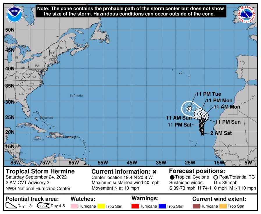
According to the latest advisory issued by the National Hurricane Center (NHC), Hermine was located about 315 miles northeast of the Cabo Verde Islands. Maximum sustained winds were 40 mph and the minimum central pressure was estimated to be 1002 mb or 29.59″. The storm is moving to the north at 10 mph.
The storm is forecast to dump very heavy rains over the Canary Islands this weekend. A northward to northeastward motion is expected into early next week while Hermine remains in tact. A turn to the northwest is expected in about 72 hours, at which point the storm should degenerate into a remnant low devoid of deep convection. Beyond Monday, the storm should be no more.
