[
The National Hurricane Center has upgraded Tropical Depression #17 to Tropical Storm Olga. While tropical storm force wind gusts are expected, no watches or warnings are up for the Gulf coast at this time. Prior to landfall, Olga should transition to a post-tropical low. Despite the meteorological technicality with what it’s being referred to as, residents of the central Gulf coast and beyond should prepare for its arrival.
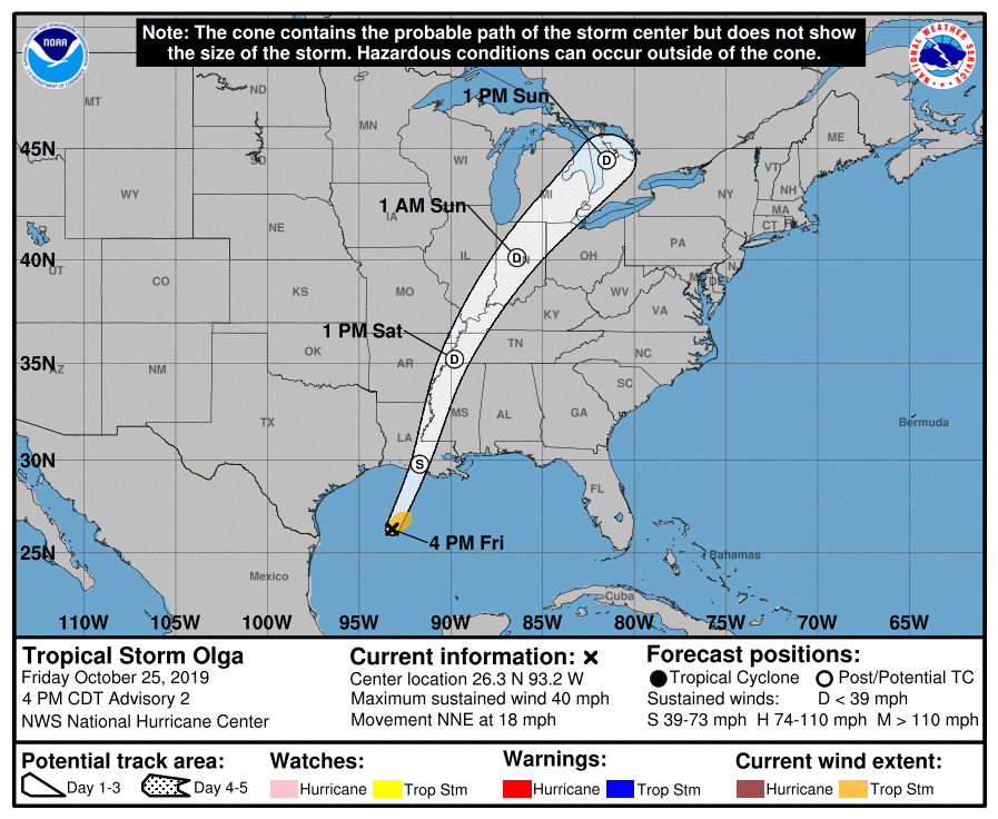
As of the last update from the National Hurricane Center, the center of Tropical Storm Olga was located near latitude 26.3 North, longitude 93.2 West. Olga is
moving toward the north-northeast near 18 mph and this motion is expected to continue with an increase in forward speed during the next couple of days. On the forecast track, the center of Olga should move over the northern Gulf coast late tonight or early Saturday and then move through the Mississippi and Ohio River Valleys later Saturday through Sunday. The forecast calls for Olga to merge with an approaching cold front and become a post-tropical low with gale-force winds tonight before the center reaches the Gulf coast. For now, the central pressure measured by Hurricane Hunter aircraft in the storm is 998 mb or 29.47 inches.
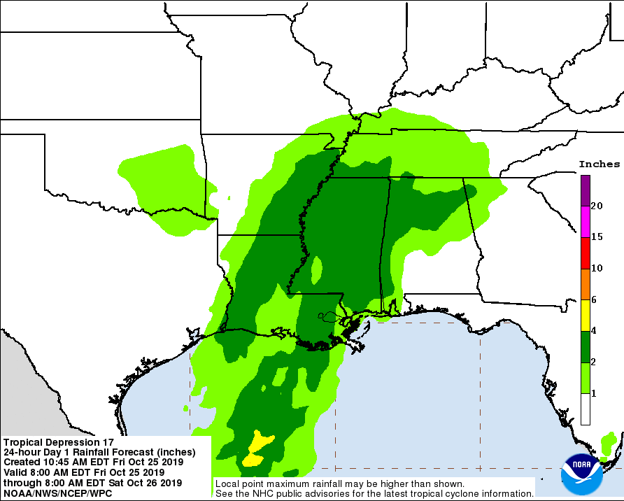
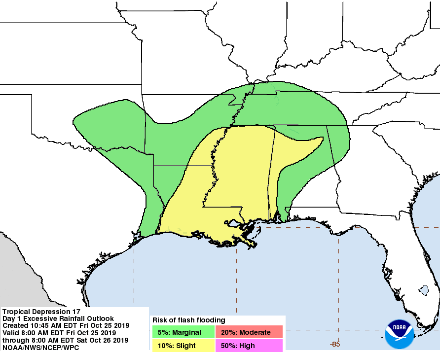
This system will bring different weather hazards with it: flooding rains, coastal flooding, and the threat of isolated tornadoes. The depression and rainfall ahead of the system along and north of the frontal boundary across the Central Gulf coast is expected to produce total rainfall accumulations of 2 to 4 inches with maximum totals of 8 inches across the Central Gulf coast into the Lower Mississippi Valley through Saturday morning. These rains may produce flash flooding across the Central Gulf coast into the Lower Mississippi Valley. Above-normal tides and associated coastal flooding are possible across portions of the northern Gulf coast. A couple tornadoes are possible through tonight across southeast portions of Louisiana and Mississippi into southwest Alabama.
Beyond landfall, the storm system is expected to bring heavy rains and gusty winds up the Mississippi River Valley and eventually over to the Ohio Valley and Mid Atlantic with time. Both the Mid Atlantic and New England could see very heavy rain on Sunday from the remnants of this system and the frontal system it is merging with.
