Tropical Storm Rosa , once a fierce hurricane, will impact the Baja Peninsula of California and weaken tomorrow night. However, very heavy rain associated from the storm system’s rich moisture field will create a plethora of problems across northwestern Mexico and the southwestern United States. The National Hurricane Center warns of flooding, debris flows, and landslides over this region for the next few days.
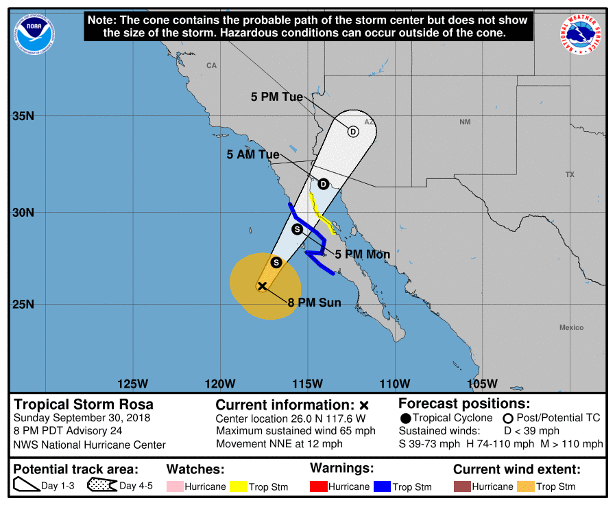
As of the latest advisory from the National Hurricane Center, the center of Tropical Storm Rosa was located near latitude 26.0 North, longitude 117.6 West. Rosa is moving toward the north-northeast near 12 mph, and this general motion is expected to continue through Tuesday. On the forecast track, the center of Rosa will approach the central and northern Baja California peninsula on Monday and then move across the peninsula into the northern Gulf of California Monday night. Rosa’s remnants will then move across the Desert Southwest on Tuesday. Maximum sustained winds have decreased to near 65 mph with higher gusts. Additional weakening is forecast through Monday night while Rosa approaches and moves over the northern Baja California peninsula. Rosa is expected to dissipate over northwestern Mexico or the southwestern United States by Tuesday. Tropical-storm-force winds extend outward up to 150 miles from the center. The estimated minimum central pressure is 989 mb or 29.21 inches.
Rosa is projected to dump very heavy rain in an area where rain doesn’t often fall. The Baja California and northwestern Sonora will see 3 to 6 inches, with isolated amounts up to 10 inches. Central and Southern Arizona will see 2-4″, with isolated 6″ amounts, especially in the mountains of Central Arizona. The rest of the Desert Southwest, Central Rockies, and Great Basin should see 1-2″ with isolated amounts up to 4″. In both Mexico and the United States, these rainfall amounts may produce life threatening flash flooding. Dangerous debris flows and landslides are also possible in mountainous terrain. Rain is likely to spread across southern California, Arizona, New Mexico, Utah, and Texas over time.
Wind issues will be confined to the Mexican coast. Tropical storm conditions are expected to first reach the coast by Monday morning. Winds should drop below tropical storm strength by tomorrow night.
