The record-breaking 2020 Atlantic Hurricane Season continues to break even new records: early this morning, in the 2am advisory from the National Hurricane Center, Tropical Depression #28 was upgraded to Tropical Storm Zeta. While it had origins as the 28th tropical depression of the year, it is the 27th named storm of the season and is the earliest forming 27th Atlantic named storm on record. The prior record for earliest Atlantic 27th named storm formation was November 29, 2005. The name “Zeta” was only used once before by a late-season tropical storm in December 2005.
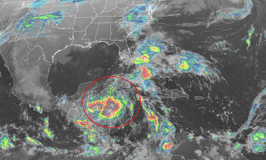
For now, Tropical Storm Zeta is meandering over the northwestern Caribbean Sea. Drifting about, currently north at 1 mph, Zeta is located at 17.7 N 83.5W roughly 295 miles southeast of Cozumel, Mexico and about 305 miles south-southeast of the western tip of Cuba. Zeta has maximum sustained winds of 40 mph while its minimum central pressure is 1005 mb or 29.68 inches.
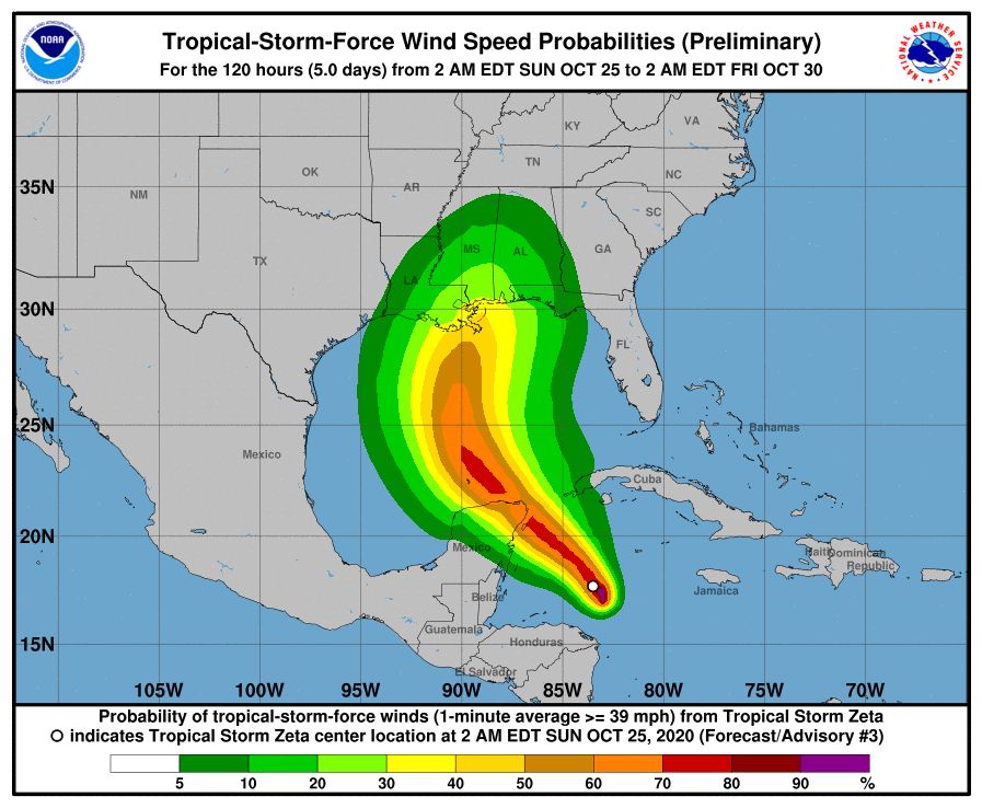
With tropical storm conditions expected in some areas within the next 36-48 hours, storm related watches and warnings have been issued. A Tropical Storm Warning is in effect for Pinar del Rio, Cuba, while a Tropical Storm Watch is in effect for the Mexican coast around Cozumel and from Tulum to Rio Lagartos. A Tropical Storm Warning means that tropical storm conditions are expected somewhere within the warning area within 36 hours, while a Tropical Storm Watch means that tropical storm conditions are possible within the watch area, generally within 48 hours.
According to the latest update from the National Hurricane Center, Zeta is currently stationary and is continuing
to re-organize. They expect Zeta to follow a slow north-northwestward to northwestward motion later today, followed by a turn toward the west-northwest and an increase in forward speed on Monday.
Over the course of the next 72 hours, a weak shortwave trough currently located over the southeastern United States from the Tennessee Valley southward into the north-central Gulf of Mexico will continue to move eastward, allowing a low- to mid-level ridge to steadily build westward across the Bahamas, Florida, and the central Gulf of Mexico. This will gradually force Zeta on a northwestward track across or near the northeastern tip of the Yucatan Peninsula in about 48 hours and into the central Gulf of Mexico by 72 hours. Thereafter, however, computer forecast guidance diverge fairly significantly due to uncertainty in the evolution of the next steering mechanism — a trough over the northwestern U.S. that will dig southward and phase with a trough off the southern California and Baja California coasts. The global forecast models remain in poor agreement on the details of the timing of the phasing and movement of the low across America, resulting in a wide variety of model solutions that eventually bring Zeta anywhere from the Louisiana coast to the Florida Panhandle.
Data from the aircraft investigating Zeta this morning indicate that maximum sustained winds are near 40 mph with higher gusts. According to the National Hurricane Center, gradual strengthening is expected during the next 48 to 72 hours, and Zeta is forecast to become a hurricane by early Tuesday.
