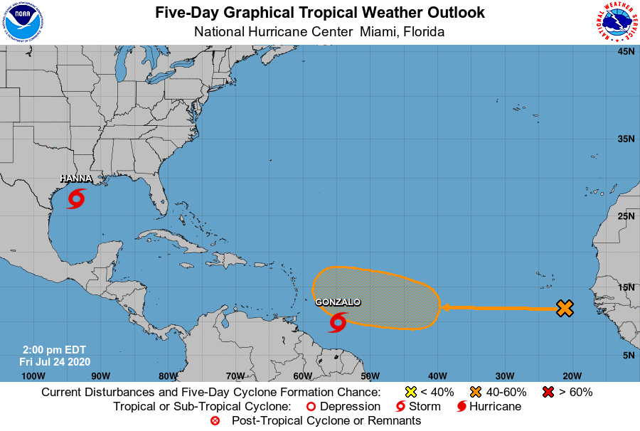
While the Central Pacific Hurricane Center is busy tracking Major Hurricane Douglas and its potential landfall on Hawaii and the National Hurricane Center is tracking both Tropical Storm Hanna and its expected landfall on Texas and Tropical Storm Gonzalo and its track through the Caribbean, a new tropical wave is getting attention in the western Atlantic. A vigorous disturbance moved off of the African coast yesterday and it is becoming more likely that a tropical cyclone will be born here.
Today, the disturbance is located about 300 miles south-southeast of the Cabo Verde Islands; it continues to produced an area of cloudiness and disorganized showers and thunderstorms. The disturbance is expected to move westward across the tropical Atlantic during the next several days, and the National Hurricane Center believes some gradual development of this system is possible by early next week when it reaches the western tropical Atlantic.
In about 5 days, it’ll be in an area north or northeast of where Tropical Storm Gonzalo is today. Some global computer forecast guidance suggests this new system will have a better environment to grow than Gonzalo had, setting the stage for a system better organized and stronger than Gonzalo has been to date.
The National Hurricane Center has doubled the odds that a system will form here since yesterday, raising those odds from 20% or “low” up to 40% or “medium.” Should this system be the next to form into a named tropical cyclone, it would be called “Isaias”.
