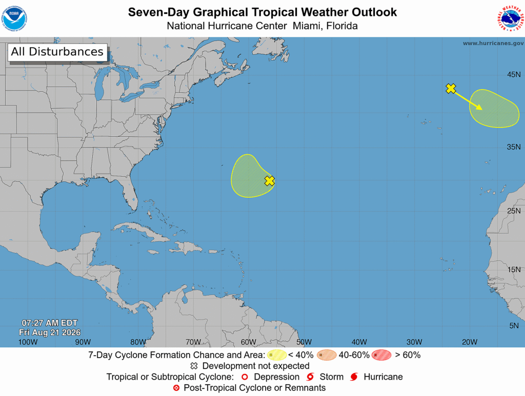
The National Hurricane Center (NHC) in Miami, Florida is tracking two areas of disturbed weather for signs of possible tropical or subtropical cyclone development. But those disturbances are not a threat to the United States nor are any expected over the next 7 days. The lack of activity in the Atlantic is the opposite of the Pacific basin, where Hawaii is about to deal with it’s second tropical cyclone impact in a week.
The first system being tracked by the NHC is in the northeastern Atlantic. According to the NHC, a non-tropical area of low pressure has developed over the northeastern Atlantic several hundred miles north-northeast of the Azores. This system could acquire some subtropical or tropical characteristics on Saturday or early Sunday while it moves east-southeastward at 10 to 15 mph toward Portugal and northwestern Spain. The opportunity of tropical or subtropical development should end by Sunday night when the system moves into unfavorable environmental conditions. For now, the NHC says there’s only a 20% chance that this area of showers and storms will develop into a cyclone.

The second system being tracked is in the central subtropical Atlantic. A weak area of low pressure located over the central subtropical Atlantic a few hundred miles east-southeast of Bermuda is producing an area of disorganized showers and thunderstorms. The NHC says that development of this system, if any, is expected to be slow to occur while it drifts west-southwestward through Sunday and then turns northward early next week. The NHC says there’s only a 10% chance of tropical cyclone formation over the next 48% hours which rises to 20% over the next 7 days.
Elsewhere, tropical cyclone development isn’t expected anywhere in the Atlantic Hurricane Basin for the next 7 days.
The Atlantic hurricane season runs through the end of November.
