Tropical Storm Olana weakened into a tropical depression today and is forecast to further degenerate into a remnant low soon; even so, heavy flooding rains are still expected in Hawaii, where a Flood Watch has now been posted for the entire state.
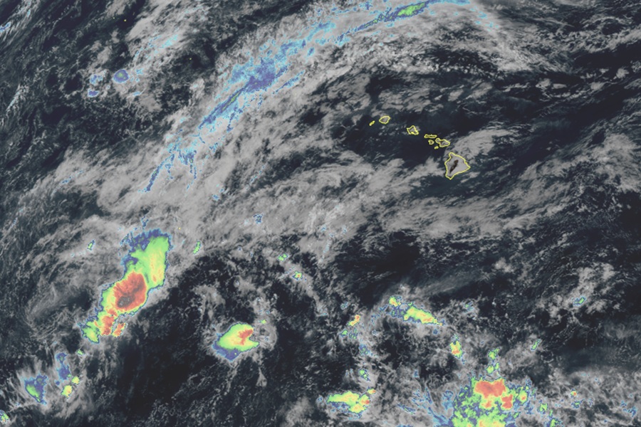
As of the latest advisory from the National Hurricane Center, Olana was located about 520 miles west-southwest of Johnston Island. With maximum sustained winds of only 35 mph, the central minimum pressure has risen to 1007 mb or 29.74″.
The depression is moving toward the southeast near 3 mph and a slow southeastward to northeastward motion is expected during the next day or two. Additional weakening is expected, and Olana is forecast to degenerate into a remnant low later today.
While Olana’s remnants will not impact Hawaii as a tropical cyclone, its deep moisture will spread into the Aloha State over the next several days. A trough extending eastward from Olana will slowly drift to within 300 miles southwest of Hawaii tonight. Meanwhile, an upper level trough, now centered over 1,000 miles west of Kauai, will advance eastward, tapping moisture aloft from thunderstorms along the surface trough and sending increased high clouds the state of Hawaii.

Chances for heavy flooding rainfall and thunderstorms will increase during the day on Tuesday. The upper level trough will edge closer to the state, and the entrance region of a jet stream aloft along the eastern flank of the feature will steadily erode the ridge aloft and provide large scale ascent over the state later in the day. This will pull the surface trough toward the islands, spreading a deep tropical airmass with precipitable water in excess of 2 inches throughout the day.
“Chances for widespread rain should remain relatively low Tuesday morning as the Flood Watch goes into effect, but as moisture increases later in the day, the flood threat will slowly increase,” cautions the Honolulu office of the National Weather Service. “The flood threat will be greatest Tuesday night through Wednesday night. The jet stream aloft will provide its strongest ascent over the region, pulling the surface trough over the state and possibly
generating an elongated surface low near or over the islands.”
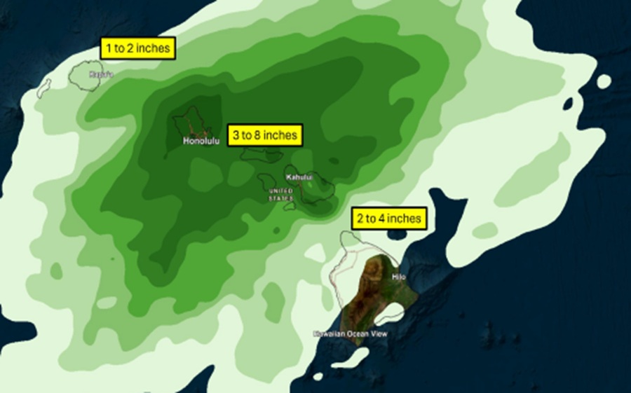
The latest computer forecast guidance favors Oahu and Maui County for the greatest rainfall from this multi-day event. However, the National Weather Service cautions that all islands will have a heavy rain threat.

There will also be the chance of strong or severe thunderstorms. In addition to lightning, these storms may have damaging wind gusts and could spawn an isolated tornado or waterspout. While there will be a threat of storms, the greater threat is for heavy rainfall and the flood threat that comes with that.
The threat of heavy rainfall will diminish Thursday and Friday. The jet stream aloft will lift to the north, and weak upper level anticyclonic flow will develop, ceasing the large scale ascent over the islands driving the significant rainfall. However, the National Weather Service cautions that a weak surface trough and ample moisture will likely linger, providing some chance for heavy showers that could require the Flood Watch to be extended.
