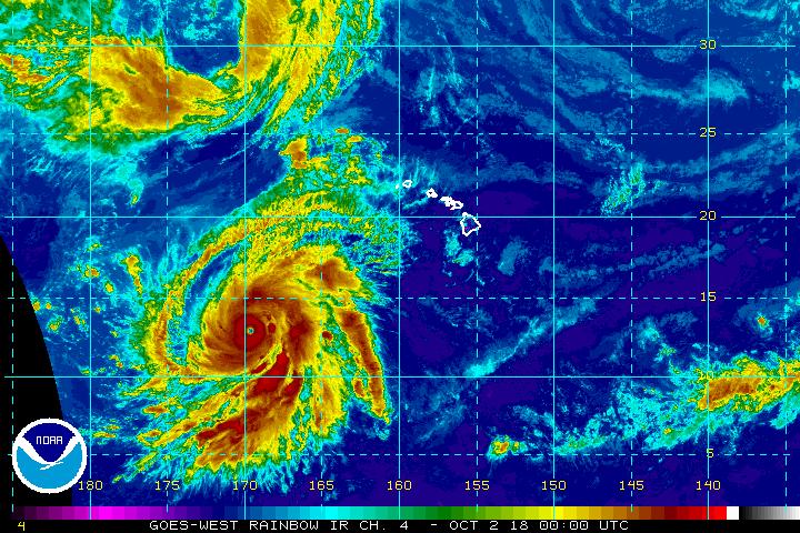
Hurricane Walaka became the latest Category 5 hurricane to blossom in the Pacific today, and meteorologists with the Central Pacific Hurricane Center don’t think it’s done gaining strength.

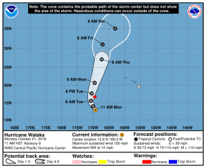
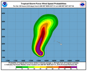
As of the last advisory from the Central Pacific Hurricane Center (CPHC), the eye of Hurricane Walaka was located near latitude 12.9 North, longitude 169.6 West. Walaka is moving toward the west-northwest near 9 mph. A turn toward the north is expected late tonight through Tuesday with a gradual increase in forward speed. On the forecast track, the center of Walaka is expected to pass just to the west of Johnston Island on Tuesday. Maximum sustained winds are near 160 mph with higher gusts. Walaka is a category 5 hurricane on the Saffir-Simpson Hurricane Wind Scale and some additional strengthening is expected through early Tuesday before Walaka starts a gradual weakening trend. Hurricane-force winds extend outward up to 50 miles from the center and tropical-storm-force winds extend outward up to 185 miles. The estimated minimum central pressure is 920 mb or 27.17 inches.
The CPHC says many factors are responsible for the rapid intensification of Major Hurricane Walaka. With sea surface temperatures under Walaka expected to remain near 86 degrees through tonight, high ocean heat content, and low vertical wind shear, the CPHC says there is no reason to believe that peak intensity has been reached.
Fortunately for Hawaii, which had to deal with Hector, Lane, and Olivia already this season, Walaka should stay far away from the main Hawaiian Islands. However, Walaka is forecast to move over or close to Johnston Island and though the Papahanaumokuakea Marine National Monument. Anyone in this area should rush out of the region as quickly as possible.
The list of names used for tropical storms and hurricanes are maintained by the United Nation’s World Meteorological Organization. Currently, only tropical cyclones are named in an official capacity; winter storms are not. The World Meteorological Organization from the United Nations develops a list of names for each ocean basin. In the United States, the National Hurricane Center maintains lists from the WMO for Atlantic Basin and eastern Pacific basin storms. Storms that form near Hawaii come from a list managed by the Central Pacific Hurricane Center which is co-located with the National Weather Service office in Honolulu. Storms are typically named in alphabetical order each season. “It is important to note that tropical cyclones/hurricanes are named neither after any particular person, nor with any preference in alphabetical sequence,” states the WMO. “The tropical cyclone/hurricane names selected are those that are familiar to the people in each region.”

The name Walaka is coming from a list different then other storms that have had direct or indirect impacts on Hawaii this season. The previous storms to pass near or through Hawaii, which were Hector, Lane, and Olivia, all formed in the Eastern Pacific basin and traveled into the Central Pacific Basin. In the case of this storm, it is forming within the Central Pacific basin west of 140°W, which means it would get a Central Pacific Basin storm name. Storms keep their name as they move from one basin to another. Unlike lists in other basins that start with the letter “A” every season, the storm name list in the Central Basin picks up where it last left off. Names are used from 4 lists and re-used unless retired. The last storm to form in the Central Pacific basin was Ulika; the next name to be used beyond Walaka will be Akoni.
It’s been more than two years since a storm was named in the Central Pacific Basin. On September 26, 2016, the National Hurricane Center classified a disturbance in the Eastern Pacific as Tropical Depression 19-E; within hours, it traveled west across 140°W , intensified, and was named Tropical Storm Ulika. The storm eventually became a Category 1 hurricane but never impacted land.